
Íomhá:Signpost at Tullog, Co. Meath - geograph.org.uk - 1753717.jpg

Size of this preview: 800 × 600 picteilín. Other resolutions: 320 × 240 picteilín | 640 × 480 picteilín | 1,024 × 768 picteilín | 1,280 × 960 picteilín | 2,560 × 1,920 picteilín | 2,816 × 2,112 picteilín.
Taispeáin leagan ardtaifigh den íomhá (2,816 × 2,112 picteilín, méid comhaid: 1.58 MB, cineál MIME: image/jpeg)
| Seo comhad as An Cómhaoin Viciméid. Tá an tuairisc as an leathanach tuairisc Cómhaoin a leanas thíos.
|
Achoimriú
| Tuairisc |
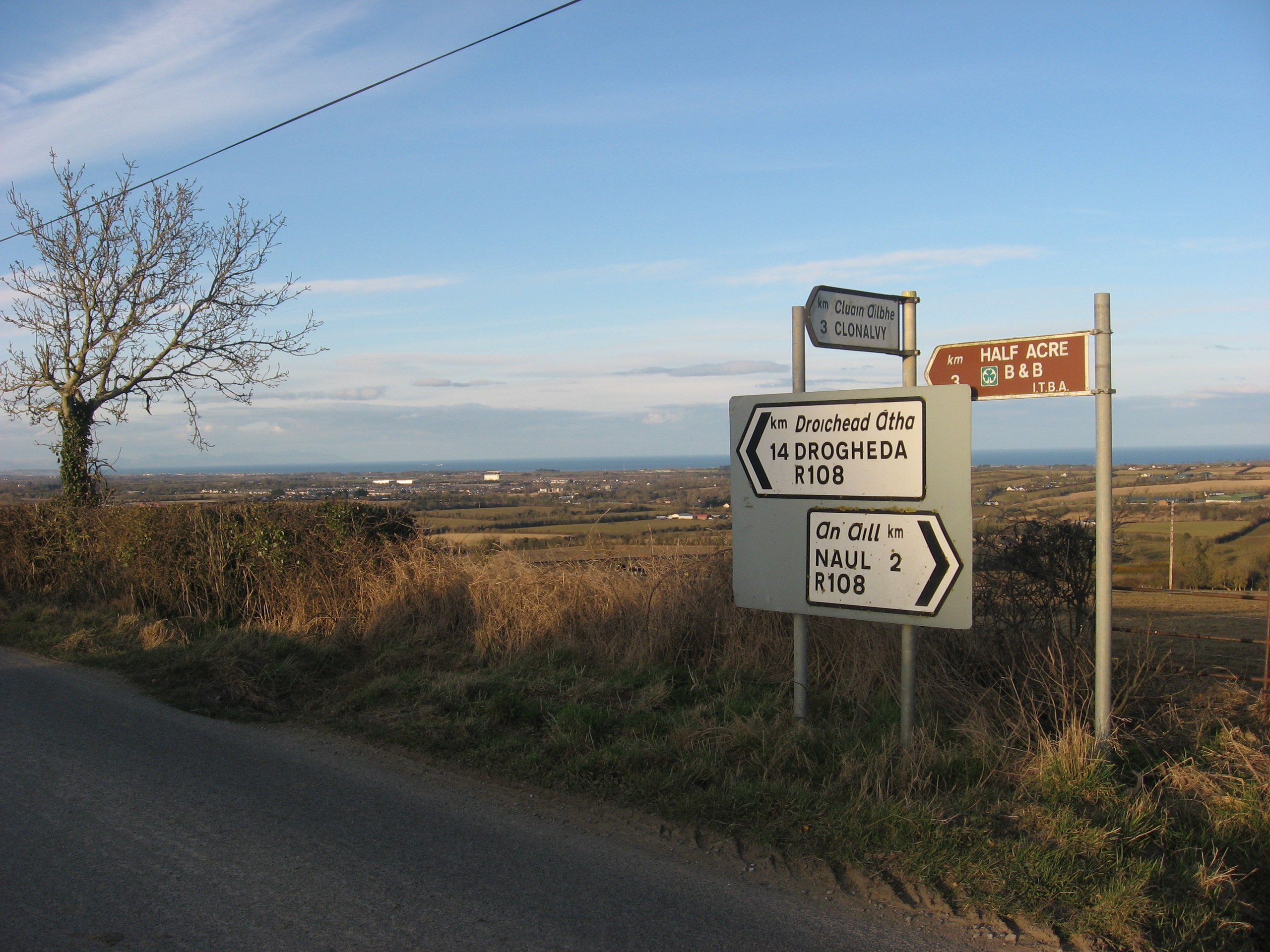
English: Signpost at Tullog, Co. Meath. The R108 road crosses the east end of Fourknocks ridge. Here it is the boundary between the townlands of Herbertstown and Tullog although the boundary on the 1836 O.S. map is shown one field further to the west. This point affords great views over east Co. Meath looking towards the sea 1764559. |
| Dáta | |
| Foinse | From geograph.org.uk |
| Údar | Kieran Campbell |
| Creidiúint (required by the license) | Kieran Campbell / Signpost at Tullog, Co. Meath / |
| Camera location | | View this and other nearby images on: OpenStreetMap |
|---|
_heading:45.00&language=ga)
| Object location | | View this and other nearby images on: OpenStreetMap |
|---|
_heading:45.00&language=ga)
Ceadúnú

|
This image was taken from the Geograph project collection. See this photograph's page on the Geograph website for the photographer's contact details. The copyright on this image is owned by Kieran Campbell and is licensed for reuse under the Creative Commons Attribution-ShareAlike 2.0 license.
|
This file is licensed under the Creative Commons Attribution-Share Alike 2.0 Generic license.
Creidiúint: Kieran Campbell
- Is féidir:
- an saothar seo a roinnt – an saothar seo a chóipeáil, a dháil amach, agus a tharchur
- an saothar seo a athmheascadh – an saothar seo a oiriúnú
- Ach amháin má leantar na coinníollacha seo a leanas:
- sannadh – Ní mor creidiúint a thabhairt leis an saothar, faoi mar a shonraigh an údar nó tabharthóir an ceadúnais (ach ná húsáid modh a thugann le fios go thacaíonn sé/sí tú féin nó an úsáid a bhaineann tú as an saothar).
- comhroinn araon – Má athraíonn tú nó síneann tú amach an saothar seo, ní féidir é a dháileadh ach amhaín faoin gceadúnas céanna nó ceann cosúil leis an gceann seo.
Stair chomhaid
Cliceáil ar dáta/am chun an comhad a radharc mar a bhí sé ag an am sin.
| Dáta/Am | Mionsamhail | Toisí | Úsáideoir | Nóta tráchta | |
|---|---|---|---|---|---|
| faoi láthair | 00:21, 6 Márta 2011 | | 2,816 × 2,112 (1.58 MB) | GeographBot | == {{int:filedesc}} == {{Information |description={{en|1=Signpost at Tullog, Co. Meath The R108 road crosses the east end of Fourknocks ridge. Here it is the boundary between the townlands of Herbertstown and Tullog although the boundary on the 1836 O.S. |
Úsáid comhaid
Tá nasc chuig an gcomhad seo ar 2 an leathanach seo a leanas:
Global file usage
The following other wikis use this file:
- Úsáid ar en.wikipedia.org
- Úsáid ar www.wikidata.org