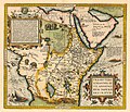
Íomhá:Prester John map.jpg

Size of this preview: 700 × 599 picteilín. Other resolutions: 280 × 240 picteilín | 561 × 480 picteilín | 897 × 768 picteilín | 1,196 × 1,024 picteilín | 2,420 × 2,072 picteilín.
Taispeáin leagan ardtaifigh den íomhá (2,420 × 2,072 picteilín, méid comhaid: 3.71 MB, cineál MIME: image/jpeg)
Stair chomhaid
Cliceáil ar dáta/am chun an comhad a radharc mar a bhí sé ag an am sin.
| Dáta/Am | Mionsamhail | Toisí | Úsáideoir | Nóta tráchta | |
|---|---|---|---|---|---|
| faoi láthair | 02:18, 15 Samhain 2018 |  | 2,420 × 2,072 (3.71 MB) | Plank | Resolución |
| 13:21, 31 Eanáir 2007 |  | 528 × 450 (54 KB) | Woudloper | {{Information |Description=A map of Prester John's kingdom as Ethiopia. (the original uploader didn't provide info on the author or date of the map) |Source=English wikipedia |Date= |Author=originally uploaded by en:user:Cuchullain |Permission={{PD-old}} |
Úsáid comhaid
Tá nasc chuig an gcomhad seo ar na leathanaigh seo a leanas:
Global file usage
The following other wikis use this file:
- Úsáid ar ca.wikipedia.org
- Úsáid ar cs.wikipedia.org
- Úsáid ar cy.wikipedia.org
- Úsáid ar de.wikipedia.org
- Úsáid ar en.wikipedia.org
- Úsáid ar es.wikipedia.org
- Úsáid ar fi.wikipedia.org
- Úsáid ar fr.wikipedia.org
- Úsáid ar gl.wikipedia.org
- Úsáid ar he.wikipedia.org
- Úsáid ar id.wikipedia.org
- Úsáid ar it.wikipedia.org
- Úsáid ar ja.wikipedia.org
- Úsáid ar nl.wikipedia.org
- Úsáid ar pt.wikipedia.org
- Úsáid ar ro.wikipedia.org
- Úsáid ar ru.wikipedia.org
- Úsáid ar sr.wikipedia.org
- Úsáid ar uk.wikipedia.org


