
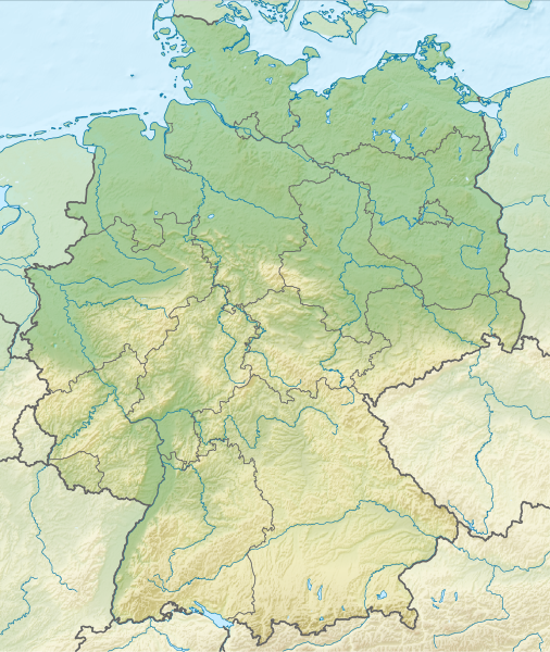
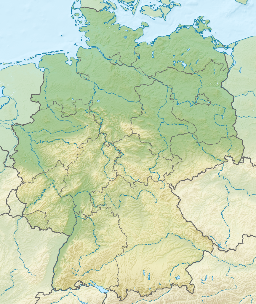
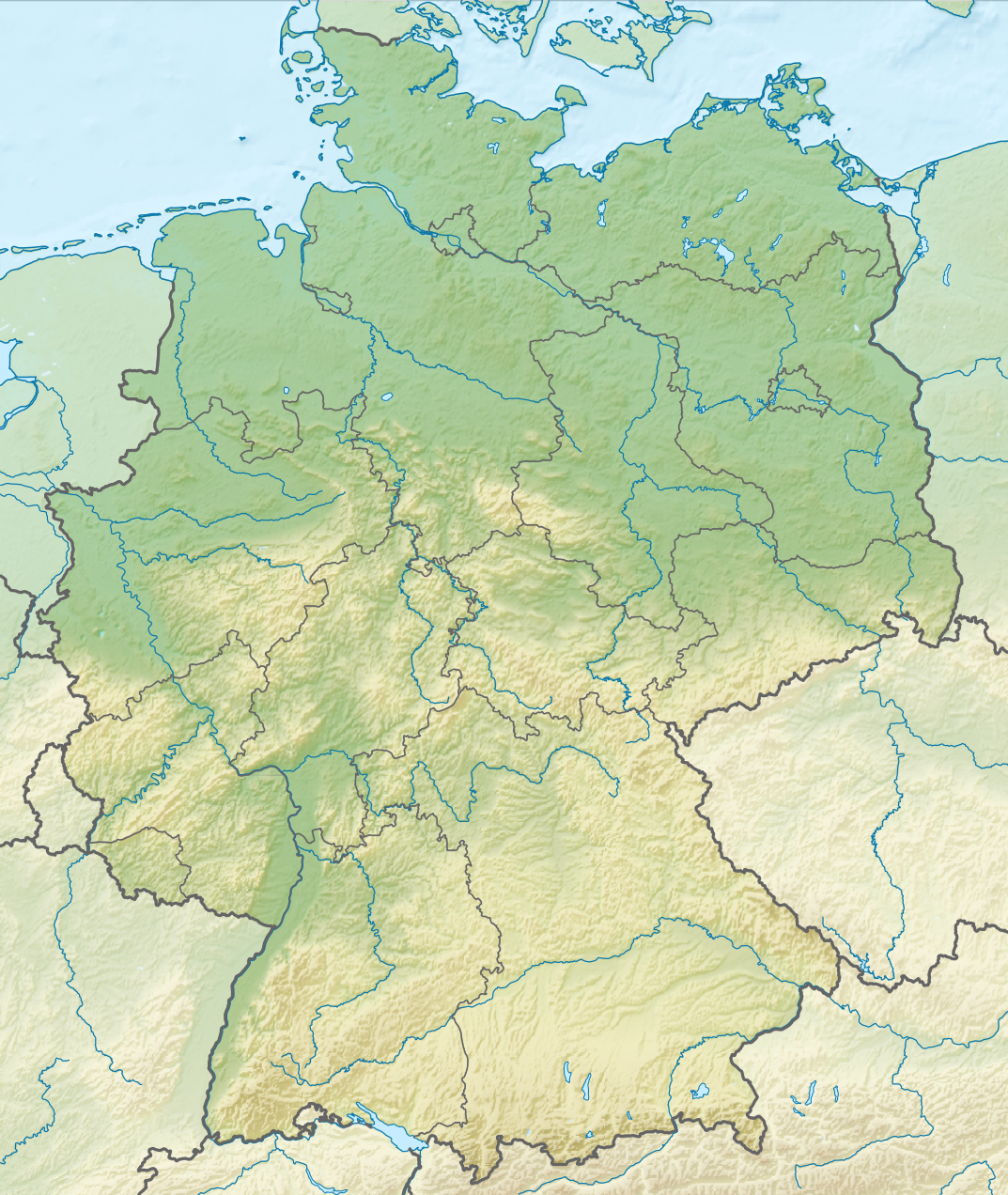
Íomhá:Relief Map of Germany.svg

Taispeáin leagan ardtaifigh den íomhá (Comhad SVG, ainmniúil 1,073 × 1,272 picteilíni, méid comhaid: 6.54 MB)
| Seo comhad as An Cómhaoin Viciméid. Tá an tuairisc as an leathanach tuairisc Cómhaoin a leanas thíos.
|
Achoimriú
| Tuairisc |
Deutsch: Positionskarte von Deutschland mit Gewässern
Quadratische Plattkarte, N-S-Streckung 150 %. Geographische Begrenzung der Karte:
English: Location map of Germany with waterbodies
Equirectangular projection, N/S stretching 150 %. Geographic limits of the map:
|
| Dáta | |
| Foinse |
Obair féin This vector image includes elements that have been taken or adapted from this file: This vector image includes elements that have been taken or adapted from this file: |
| Údar |
TUBS |
| Leaganacha eile |
Bundesrepublik Deutschland (vor 1990 nur West-Deutschland):
Deutsche Demokratische Republik (mit BRD im Ausschnitt):
Ostdeutschland (vor 1990 Deutsche Demokratische Republik):
Deutschland zwischen Mai 1945 und Oktober 1949:
Thematisch:
Deutsches Reich (1918–1945) (best used with this template (de)):
|
| SVG genesis |


_23_May_1949_-_6_Oct_1949.svg)


_location_map.svg)
_location_map_2013.svg)


Ceadúnú
- Is féidir:
- an saothar seo a roinnt – an saothar seo a chóipeáil, a dháil amach, agus a tharchur
- an saothar seo a athmheascadh – an saothar seo a oiriúnú
- Ach amháin má leantar na coinníollacha seo a leanas:
- sannadh – Ní mor creidiúint a thabhairt leis an saothar, faoi mar a shonraigh an údar nó tabharthóir an ceadúnais (ach ná húsáid modh a thugann le fios go thacaíonn sé/sí tú féin nó an úsáid a bhaineann tú as an saothar).
- comhroinn araon – Má athraíonn tú nó síneann tú amach an saothar seo, ní féidir é a dháileadh ach amhaín faoin gceadúnas céanna nó ceann cosúil leis an gceann seo.

|
I'd greatly appreciate, that you attribute this media file to Wikimedia Commons, if used outside Wikipedia or Commons. For use in publications such as books, newspapers, blogs, websites, please insert here the following line:
|
Stair chomhaid
Cliceáil ar dáta/am chun an comhad a radharc mar a bhí sé ag an am sin.
| Dáta/Am | Mionsamhail | Toisí | Úsáideoir | Nóta tráchta | |
|---|---|---|---|---|---|
| faoi láthair | 14:00, 1 Nollaig 2011 | | 1,073 × 1,272 (6.54 MB) | TUBS |
Úsáid comhaid
Ní úsáideann leathanach ar bith an comhad seo.
Global file usage
Úsáidtear an comhad seo ar na vicithe seo a leanas:
- Úsáid ar an.wikipedia.org
- Úsáid ar ar.wikipedia.org
- Úsáid ar ast.wikipedia.org
- Úsáid ar az.wikipedia.org
- Úsáid ar ban.wikipedia.org
- Taman Nasional Swiss Saxon
- Taman Nasional Hunsrück-Hochwald
- Taman Nasional Eifel
- Taman Nasional Hainich
- Taman Nasional Kellerwald-Edersee
- Taman Nasional Harz
- Taman Nasional Lebah Oder Sor
- Taman Nasional Müritz
- Taman Nasional Wawengkon Laguna Pomerania Kawan
- Taman Nasional Jasmund
- Taman Nasional Segara Wadden Saxon Sor
- Danu Laacher
- Úsáid ar ba.wikipedia.org
- Úsáid ar be.wikipedia.org
View more global usage of this file.