
Íomhá:Prefecture map of Crete (Greece).svg

Size of this PNG preview of this SVG file: 693 × 599 picteilín. Other resolutions: 278 × 240 picteilín | 555 × 480 picteilín | 888 × 768 picteilín | 1,184 × 1,024 picteilín | 2,369 × 2,048 picteilín | 8,460 × 7,315 picteilín.
Taispeáin leagan ardtaifigh den íomhá (Comhad SVG, ainmniúil 8,460 × 7,315 picteilíni, méid comhaid: 1.82 MB)
| Seo comhad as An Cómhaoin Viciméid. Tá an tuairisc as an leathanach tuairisc Cómhaoin a leanas thíos.
|
.svg)
Achoimriú
| Tuairisc |
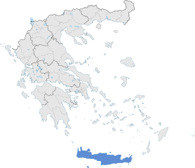
English: The prefecture of Crete within Greece. |
| Dáta | |
| Foinse | Obair féin |
| Údar | SilentResident,Philly boy92 |
Ceadúnú
Is mise sealbhóir cóipchirt an shaothair seo agus foilsím é faoin gceadúnas seo a leanas:
This file is licensed under the Creative Commons Attribution-Share Alike 3.0 Unported license.
- Is féidir:
- an saothar seo a roinnt – an saothar seo a chóipeáil, a dháil amach, agus a tharchur
- an saothar seo a athmheascadh – an saothar seo a oiriúnú
- Ach amháin má leantar na coinníollacha seo a leanas:
- sannadh – Ní mor creidiúint a thabhairt leis an saothar, faoi mar a shonraigh an údar nó tabharthóir an ceadúnais (ach ná húsáid modh a thugann le fios go thacaíonn sé/sí tú féin nó an úsáid a bhaineann tú as an saothar).
- comhroinn araon – Má athraíonn tú nó síneann tú amach an saothar seo, ní féidir é a dháileadh ach amhaín faoin gceadúnas céanna nó ceann cosúil leis an gceann seo.
Stair chomhaid
Cliceáil ar dáta/am chun an comhad a radharc mar a bhí sé ag an am sin.
| Dáta/Am | Mionsamhail | Toisí | Úsáideoir | Nóta tráchta | |
|---|---|---|---|---|---|
| faoi láthair | 18:00, 17 Eanáir 2015 | | 8,460 × 7,315 (1.82 MB) | SilentResident | The Map has been updated to include some missing territories of Greece; fixed outline and color differences for some Greek islands in the Ionian and Aegean Seas that could confuse the readers. |
| 22:34, 16 Eanáir 2015 |  | 7,304 × 7,315 (1.74 MB) | SilentResident | {{Information |Description ={{en|1=The prefecture of Crete within Greece.}} |Source ={{own}} |Author =SilentResident,Philly boy92 |Date =2014-01-16 |Permission = |other_vers... |
Úsáid comhaid
Tá nasc chuig an gcomhad seo ar na leathanaigh seo a leanas:
Global file usage
The following other wikis use this file:
- Úsáid ar ar.wikipedia.org
- Úsáid ar ast.wikipedia.org
- Úsáid ar ca.wikipedia.org
- Úsáid ar diq.wikipedia.org
- Úsáid ar el.wikipedia.org
- Úsáid ar en.wikipedia.org
- Úsáid ar en.wikivoyage.org
- Úsáid ar eu.wikipedia.org
- Úsáid ar fi.wiktionary.org
- Úsáid ar gl.wikipedia.org
- Úsáid ar ha.wikipedia.org
- Úsáid ar hy.wikipedia.org
- Úsáid ar hyw.wikipedia.org
- Úsáid ar ia.wikipedia.org
- Úsáid ar la.wikipedia.org
- Úsáid ar lb.wikipedia.org
- Úsáid ar mzn.wikipedia.org
- Úsáid ar tr.wikipedia.org
- Úsáid ar tt.wikipedia.org
- Úsáid ar www.wikidata.org
.svg)