
Íomhá:Mexico map, MX-JAL.svg

Size of this PNG preview of this SVG file: 800 × 544 picteilín. Other resolutions: 320 × 218 picteilín | 640 × 435 picteilín | 1,024 × 696 picteilín | 1,280 × 870 picteilín | 2,560 × 1,741 picteilín | 1,000 × 680 picteilín.
Taispeáin leagan ardtaifigh den íomhá (Comhad SVG, ainmniúil 1,000 × 680 picteilíni, méid comhaid: 267 KB)
| Seo comhad as An Cómhaoin Viciméid. Tá an tuairisc as an leathanach tuairisc Cómhaoin a leanas thíos.
|
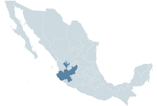
| Tuairisc | Locator map for the state of Jalisco within Mexico. | ||||
| Dáta | 04-07-2007 | ||||
| Foinse | Mexico template.svg by Mario Fuente Cid and Lokal_Profil | ||||
| Údar | Lokal_Profil | ||||
| Ceadúnas (Athúsáid a bhaint as an gcomhad seo) |
Original image licensed under
|
Stair chomhaid
Cliceáil ar dáta/am chun an comhad a radharc mar a bhí sé ag an am sin.
| Dáta/Am | Mionsamhail | Toisí | Úsáideoir | Nóta tráchta | |
|---|---|---|---|---|---|
| faoi láthair | 00:48, 13 Márta 2012 | | 1,000 × 680 (267 KB) | Addicted04 | Reverted to version as of 01:48, 29 September 2009 |
| 00:04, 18 Samhain 2009 |  | 1,000 × 680 (123 KB) | Addicted04 | Reverted to version as of 01:34, 19 November 2007 | |
| 01:48, 29 Meán Fómhair 2009 |  | 1,000 × 680 (267 KB) | Addicted04 | States borders | |
| 01:34, 19 Samhain 2007 |  | 1,000 × 680 (123 KB) | El bart089 | Based on the image made by Lokal Profil | |
| 17:27, 4 Iúil 2007 |  | 1,000 × 680 (117 KB) | Lokal Profil | {{Information |Description=Locator map for the state of Category:Jalisco within Mexico. |Source=Image:Mexico template.svg by Mario Fuente Cid <small>and Lokal_Profil</small> |Date=04-07-2007 |Author=[[: |
Úsáid comhaid
Níl nasc ó aon leathanach eile don íomhá seo.
Global file usage
The following other wikis use this file:
- Úsáid ar an.wikipedia.org
- Úsáid ar ay.wikipedia.org
- Úsáid ar br.wikipedia.org
- Úsáid ar chy.wikipedia.org
- Úsáid ar en.wikipedia.org
- Úsáid ar en.wiktionary.org
- Úsáid ar es.wikipedia.org
- Úsáid ar fr.wikipedia.org
- Úsáid ar hu.wikipedia.org
- Úsáid ar hy.wikipedia.org
- Úsáid ar incubator.wikimedia.org
- Úsáid ar ka.wikipedia.org
- Úsáid ar lv.wikipedia.org
- Úsáid ar mr.wikipedia.org
- Úsáid ar nn.wikipedia.org
- Úsáid ar pl.wikipedia.org
- Úsáid ar pt.wikipedia.org
- Úsáid ar qu.wikipedia.org
- Úsáid ar scn.wikipedia.org
- Úsáid ar sco.wikipedia.org
- Úsáid ar sv.wikipedia.org
- Úsáid ar sw.wikipedia.org
- Úsáid ar uk.wikipedia.org