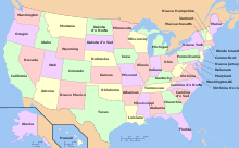
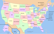
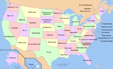
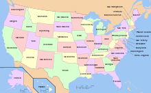
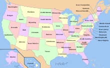
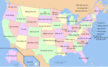
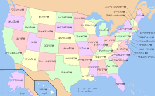
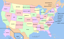
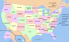
Íomhá:Map of USA with state names ru.svg
Page contents not supported in other languages.
Cuma
Ón Vicipéid, an chiclipéid shaor.

Size of this PNG preview of this SVG file: 800 × 495 picteilín. Other resolutions: 320 × 198 picteilín | 640 × 396 picteilín | 1,024 × 633 picteilín | 1,280 × 791 picteilín | 2,560 × 1,583 picteilín | 959 × 593 picteilín.
Taispeáin leagan ardtaifigh den íomhá (Comhad SVG, ainmniúil 959 × 593 picteilíni, méid comhaid: 334 KB)
| Seo comhad as An Cómhaoin Viciméid. Tá an tuairisc as an leathanach tuairisc Cómhaoin a leanas thíos.
|
| This is a retouched picture, which means that it has been digitally altered from its original version. Modifications: localized ru. The original can be viewed here: Map of USA with state names.svg:
|
Is mise sealbhóir cóipchirt an shaothair seo agus foilsím é faoi na ceadúnais seo a leanas:
This file is licensed under the Creative Commons Attribution-Share Alike 3.0 Unported, 2.5 Generic, 2.0 Generic and 1.0 Generic license.
- Is féidir:
- an saothar seo a roinnt – an saothar seo a chóipeáil, a dháil amach, agus a tharchur
- an saothar seo a athmheascadh – an saothar seo a oiriúnú
- Ach amháin má leantar na coinníollacha seo a leanas:
- sannadh – Ní mor creidiúint a thabhairt leis an saothar, faoi mar a shonraigh an údar nó tabharthóir an ceadúnais (ach ná húsáid modh a thugann le fios go thacaíonn sé/sí tú féin nó an úsáid a bhaineann tú as an saothar).
- comhroinn araon – Má athraíonn tú nó síneann tú amach an saothar seo, ní féidir é a dháileadh ach amhaín faoin gceadúnas céanna nó ceann cosúil leis an gceann seo.

|
Tugtar cead an doiciméad seo a chóipeáil, a dháileadh agus/nó a mhodhnú faoi théarmaí an Ceadúnas Doiciméadúcháin Saor ó GNU, Leagan 1.2 nó aon leagan níos déanaí a d’fhoilsigh an Fondúireacht Bogearraí Saor in Aisce; gan aon Rannóga Inmheánacha, gan aon Téacsanna Clúdaigh Tosaigh, agus gan aon Téacsanna Clúdaigh Cúil. Tá cóip den cheadúnas san áireamh sa chuid dar teideal Ceadúnas Doiciméadúcháin Saor ó GNU.http://www.gnu.org/copyleft/fdl.htmlGFDLGNU Free Documentation Licensetruetrue |
Is féidir leat a roghnú an ceadúnas do rogha
Original upload log
This image is a derivative work of the following images:
- File:Map_of_USA_with_state_names.svg licensed with Cc-by-sa-3.0,2.5,2.0,1.0, GFDL
- 2007-06-11T13:23:48Z Andrew c 959x593 (339488 Bytes)
- 2007-04-17T06:15:06Z Andrew c 959x593 (336711 Bytes)
- 2005-12-28T18:36:54Z Dbenbenn 959x593 (317355 Bytes) fix error in
- 2005-10-09T22:14:30Z Dbenbenn 959x593 (339217 Bytes) fixed by [[User:Ed g2s]] (removed tag), and me (removed undisplayed shapes: rivers, lakes, capitals, highways. Cropped. Fixed typos.)
- 2005-10-09T22:12:53Z Dbenbenn 990x855 (978926 Bytes) original version from [[w:Image:Map of USA with state names.svg]] by [[w:User:Wapcaplet]], cc-by-2.0
Uploaded with derivativeFX
Captions
Add a one-line explanation of what this file represents
Items portrayed in this file
taispeánann sé/sí
1 Aibreán 2009
Stair chomhaid
Cliceáil ar dáta/am chun an comhad a radharc mar a bhí sé ag an am sin.
| Dáta/Am | Mionsamhail | Toisí | Úsáideoir | Nóta tráchta | |
|---|---|---|---|---|---|
| faoi láthair | 11:29, 1 Aibreán 2009 |  | 959 × 593 (334 KB) | Monfornot | moved west virginia further left |
| 11:26, 1 Aibreán 2009 |  | 959 × 593 (334 KB) | Monfornot | moved labels a bit | |
| 10:54, 1 Aibreán 2009 |  | 959 × 593 (334 KB) | Monfornot | {{Information |Description=Map of USA with state names |Source=*File:Map_of_USA_with_state_names.svg |Date=2009-04-01 11:52 (UTC) |Author=*File:Map_of_USA_with_state_names.svg: Dbenbenn *derivative work: ~~~ |Permission=see |
Úsáid comhaid
Ní úsáideann leathanach ar bith an comhad seo.


