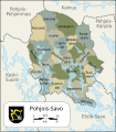
Íomhá:Map of Northern Savonia-fi.svg

Size of this PNG preview of this SVG file: 527 × 600 picteilín. Other resolutions: 211 × 240 picteilín | 422 × 480 picteilín | 675 × 768 picteilín | 900 × 1,024 picteilín | 1,799 × 2,048 picteilín | 694 × 790 picteilín.
Taispeáin leagan ardtaifigh den íomhá (Comhad SVG, ainmniúil 694 × 790 picteilíni, méid comhaid: 147 KB)
Stair chomhaid
Cliceáil ar dáta/am chun an comhad a radharc mar a bhí sé ag an am sin.
| Dáta/Am | Mionsamhail | Toisí | Úsáideoir | Nóta tráchta | |
|---|---|---|---|---|---|
| faoi láthair | 12:06, 3 Márta 2019 |  | 694 × 790 (147 KB) | Fenn-O-maniC | Updated Kuopio |
| 16:44, 27 Aibreán 2013 |  | 694 × 790 (149 KB) | Fenn-O-maniC | Corrected the lakes | |
| 15:09, 16 Feabhra 2013 |  | 694 × 790 (135 KB) | Fenn-O-maniC | Corrected the borders of Kuopio, also changed the hue of green to make it more visible. | |
| 07:37, 19 Iúil 2010 |  | 694 × 790 (134 KB) | Mysid | trying another fonts (Dejavu Sans Condensed, Bitstream Vera Serif) | |
| 07:23, 19 Iúil 2010 |  | 694 × 790 (133 KB) | Mysid | add lakes + use Liberation Sans for a less messy look | |
| 08:31, 17 Iúil 2010 |  | 694 × 790 (134 KB) | Mysid | == Summary == {{Information |Description={{en|1=Map of the municipalities of the Northern Savonia region of Finland.}} {{fi|1=Kartta Pohjois-Savon maakunnan kunnista.}} |Source=Self-made in Inkscape. Base map from File:Map of Finland-en.svg; municipa |
Úsáid comhaid
Tá nasc chuig an gcomhad seo ar na leathanaigh seo a leanas:
Global file usage
The following other wikis use this file:
- Úsáid ar avk.wikipedia.org
- Úsáid ar ca.wikipedia.org
- Úsáid ar en.wikipedia.org
- Úsáid ar fi.wikipedia.org
- Úsáid ar gl.wikipedia.org
- Úsáid ar os.wikipedia.org
- Úsáid ar pl.wikipedia.org
- Úsáid ar ru.wikipedia.org
- Úsáid ar www.wikidata.org


