
Íomhá:Sulphur Tornado Radar Image.png
Size of this preview: 800 × 394 picteilín. Other resolutions: 320 × 158 picteilín | 640 × 315 picteilín | 1,024 × 505 picteilín | 1,280 × 631 picteilín | 2,322 × 1,144 picteilín.
Taispeáin leagan ardtaifigh den íomhá (2,322 × 1,144 picteilín, méid comhaid: 5.03 MB, cineál MIME: image/png)
| Seo comhad as An Cómhaoin Viciméid. Tá an tuairisc as an leathanach tuairisc Cómhaoin a leanas thíos.
|
Achoimriú
| Tuairisc |
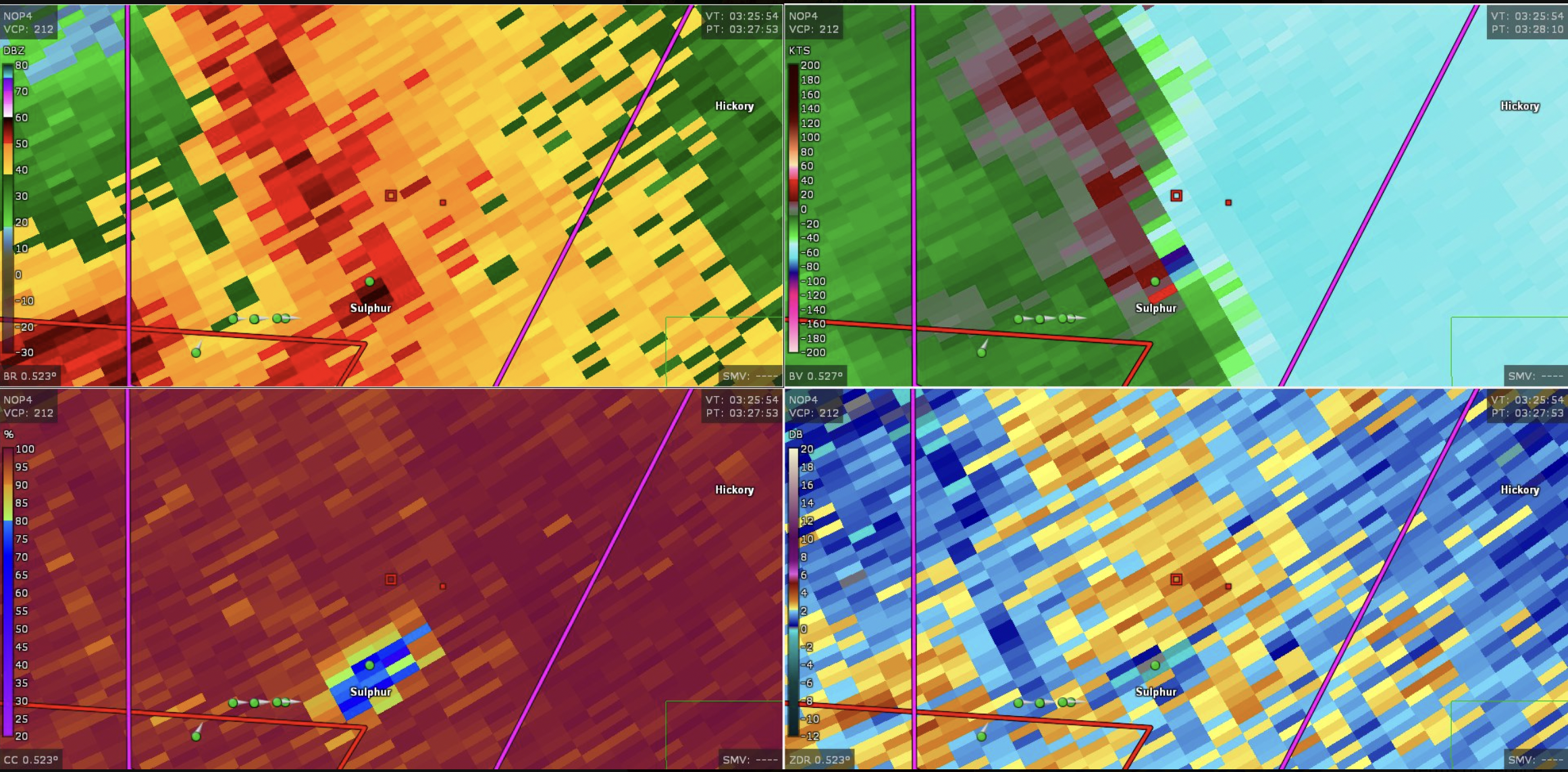
English: This image shows the radar presentation of a damaging tornado in Sulphu,r Oklahoma on April 27, 2024. |
| Dáta | |
| Foinse | NEXRAD |
| Údar | National Weather Service, Federal Aviation Administration, United States Air Force |
Ceadúnú
This image is in the public domain because it is from one or more of the U.S. government’s 159 NEXRAD radars, which are jointly owned and operated by the National Weather Service (NWS), an agency of the National Oceanic and Atmospheric Administration (NOAA) within the United States Department of Commerce, the Federal Aviation Administration (FAA) within the Department of Transportation, and the U.S. Air Force within the Department of Defense.
Thus all NEXRAD images are public domain.
|
  |
Stair chomhaid
Cliceáil ar dáta/am chun an comhad a radharc mar a bhí sé ag an am sin.
| Dáta/Am | Mionsamhail | Toisí | Úsáideoir | Nóta tráchta | |
|---|---|---|---|---|---|
| faoi láthair | 19:44, 28 Aibreán 2024 | | 2,322 × 1,144 (5.03 MB) | Floriangkmcc | Uploaded a work by The National Weather Service from Nexrad Radar with UploadWizard |
Úsáid comhaid
Níl nasc ó aon leathanach eile don íomhá seo.