
Íomhá:Satellite image of Andorra on Landsat7.jpg
Size of this preview: 697 × 599 picteilín. Other resolutions: 279 × 240 picteilín | 558 × 480 picteilín | 893 × 768 picteilín | 1,099 × 945 picteilín.
Taispeáin leagan ardtaifigh den íomhá (1,099 × 945 picteilín, méid comhaid: 228 KB, cineál MIME: image/jpeg)
| Seo comhad as An Cómhaoin Viciméid. Tá an tuairisc as an leathanach tuairisc Cómhaoin a leanas thíos.
|
Achoimriú
| Tuairisc |
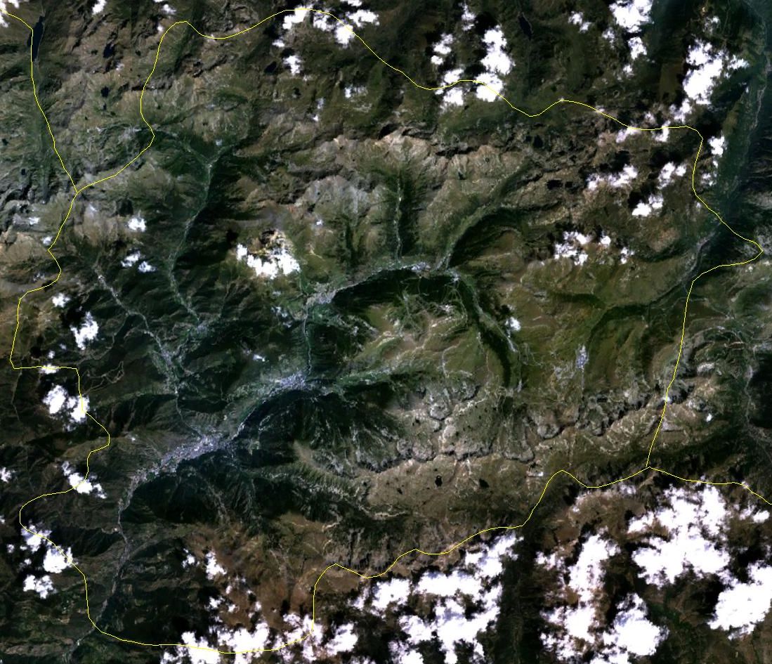
English: Satellite image of Andorra in August. Borders approximate. Taken from Landsat7. |
||
| Dáta | 6 Deireadh Fómhair 2005 (upload date) | ||
| Foinse | Public domain satellite imagery taken by screenshot from NASA World Wind software. URL: worldwind://goto/world=Earth&lat=42.55616&lon=1.62127&alt=37335 | ||
| Údar | NASA | ||
| Leaganacha eile |
|

Ceadúnú
| This image is in the public domain because it is a screenshot from NASA’s globe software World Wind using a public domain layer, such as Blue Marble, MODIS, Landsat, SRTM, USGS or GLOBE.
|
 |
Stair chomhaid
Cliceáil ar dáta/am chun an comhad a radharc mar a bhí sé ag an am sin.
| Dáta/Am | Mionsamhail | Toisí | Úsáideoir | Nóta tráchta | |
|---|---|---|---|---|---|
| faoi láthair | 11:53, 6 Deireadh Fómhair 2005 | | 1,099 × 945 (228 KB) | Hautala | {{PD-USGov-NASA}} Satellite image of Andorra. Borders approximate. Taken from Landat7. Image captured from NASA World Wind. Location: worldwind://goto/world=Earth&lat=42.55616&lon=1.62127&alt=37335 |
Úsáid comhaid
Níl nasc ó aon leathanach eile don íomhá seo.
Global file usage
The following other wikis use this file:
- Úsáid ar azb.wikipedia.org
- Úsáid ar el.wikipedia.org
- Úsáid ar en.wikipedia.org
- Úsáid ar it.wikipedia.org
- Úsáid ar it.wikibooks.org
- Úsáid ar oc.wiktionary.org
- Úsáid ar pl.wikipedia.org
- Úsáid ar vec.wikipedia.org