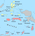
Íomhá:Map of Maluku Islands-en.svg
Cuma

Size of this PNG preview of this SVG file: 593 × 600 picteilín. Other resolutions: 237 × 240 picteilín | 474 × 480 picteilín | 759 × 768 picteilín | 1,012 × 1,024 picteilín | 2,024 × 2,048 picteilín | 1,363 × 1,379 picteilín.
Taispeáin leagan ardtaifigh den íomhá (Comhad SVG, ainmniúil 1,363 × 1,379 picteilíni, méid comhaid: 329 KB)
Stair chomhaid
Cliceáil ar dáta/am chun an comhad a radharc mar a bhí sé ag an am sin.
| Dáta/Am | Mionsamhail | Toisí | Úsáideoir | Nóta tráchta | |
|---|---|---|---|---|---|
| faoi láthair | 08:00, 22 Deireadh Fómhair 2012 |  | 1,363 × 1,379 (329 KB) | Mysid | Atauro belongs to East Timor |
| 16:15, 17 Aibreán 2011 |  | 1,363 × 1,379 (372 KB) | Mysid | remove curved text (not working) | |
| 16:13, 17 Aibreán 2011 |  | 1,363 × 1,379 (372 KB) | Mysid | {{Information |Description ={{en|1=Map of the Maluku Islands.}} |Source ={{own}} - self-made in Inkscape. |Author =Mysid |Date =2010-04-17 |Permission = |other_versions = }} [[Cate |
Úsáid comhaid
Tá nasc chuig an gcomhad seo ar na leathanaigh seo a leanas:
Global file usage
Úsáidtear an comhad seo ar na vicithe seo a leanas:
- Úsáid ar af.wikipedia.org
- Úsáid ar ar.wikipedia.org
- Úsáid ar el.wikipedia.org
- Úsáid ar en.wikipedia.org
- Úsáid ar eo.wikipedia.org
- Úsáid ar fa.wikipedia.org
- Úsáid ar id.wikipedia.org
- Úsáid ar ilo.wikipedia.org
- Úsáid ar incubator.wikimedia.org
- Úsáid ar ja.wikipedia.org
- Úsáid ar min.wikipedia.org
- Úsáid ar ml.wikipedia.org
- Úsáid ar mrj.wikipedia.org
- Úsáid ar nl.wikipedia.org
- Úsáid ar pnb.wikipedia.org
- Úsáid ar sw.wikipedia.org
- Úsáid ar tr.wikipedia.org
- Úsáid ar ur.wikipedia.org
- Úsáid ar war.wikipedia.org
