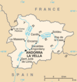
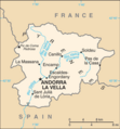
Íomhá:Andorra map - 2.png

Page contents not supported in other languages.
Ón Vicipéid, an chiclipéid shaor.

Andorra_map_-_2.png(325 × 347 picteilín, méid comhaid: 15 KB, cineál MIME: image/png)

Seo comhad as An Cómhaoin Viciméid. Tá an tuairisc as an leathanach tuairisc Cómhaoin a leanas thíos.
Is stór comhaid meáin Saor é an Cómhaoin Viciméid. Is féidir leat cabhrú.

Achoimriú

Tuairisc
English: Map of Andorra
Italiano: Mappa di Andorra
Dáta
Foinse https://www.cia.gov/library/publications/the-world-factbook/maps/maptemplate_an.html
Údar Directorate of Intelligence, CIA

Ceadúnú

Public domain
This image is in the public domain because it contains materials that originally came from the United States Central Intelligence Agency's World Factbook.

Bahasa Indonesia  čeština  Deutsch  eesti  English  español  Esperanto  français  galego  hrvatski  italiano  Nederlands  norsk nynorsk  polski  português  sicilianu  slovenščina  suomi  Türkçe  Zazaki  беларуская (тарашкевіца)  македонски  русский  српски / srpski  українська  ქართული  বাংলা  தமிழ்  മലയാളം  한국어  日本語  中文  中文(简体)  中文(繁體)  العربية  +/−

Original upload log

Dáta/Am Toisí Úsáideoir Nóta tráchta
15 Márta 2013, 16:06:12 328 × 353 (15867 bytes) Edoardo Cavaleri (plé · dréachtaí) {{Information |Description ={{en|1=Map of Andorra}} {{it|1=Mappa di Andorra}} |Source =https://www.cia.gov/library/publications/the-world-factbook/maps/maptemplate_an.html |Author =Directorate of Intelligence, CIA |Date =15...

Captions

Add a one-line explanation of what this file represents

Items portrayed in this file

taispeánann sé/sí

15 Márta 2013

media type Béarla

image/png

checksum Béarla

4d934f16a95ffed67a1aa7b0b41f32f89bbf8e5c

determination method Béarla: SHA-1 Béarla

data size Béarla

14,951 Beart

347 picteilín

325 picteilín

Stair chomhaid

Cliceáil ar dáta/am chun an comhad a radharc mar a bhí sé ag an am sin.

Dáta/AmMionsamhailToisíÚsáideoirNóta tráchta
faoi láthair07:45, 19 Feabhra 2022Mionsamhail do leagan ó 07:45, 19 Feabhra 2022325 × 347 (15 KB)LojweCropped 1 % horizontally, 2 % vertically using CropTool with precise mode.
15:54, 16 Lúnasa 2014Mionsamhail do leagan ó 15:54, 16 Lúnasa 2014328 × 353 (19 KB)GifTaggerBot: Converting file to superior PNG file. (Source: Andorra_map.gif). This GIF was problematic due to non-greyscale color table.

Níl nasc ó aon leathanach eile don íomhá seo.

Global file usage

The following other wikis use this file:

Meiteasonraí