
Íomhá:USA Louisiana location map.svg

Size of this PNG preview of this SVG file: 622 × 599 picteilín. Other resolutions: 249 × 240 picteilín | 498 × 480 picteilín | 797 × 768 picteilín | 1,063 × 1,024 picteilín | 2,126 × 2,048 picteilín | 1,201 × 1,157 picteilín.
Taispeáin leagan ardtaifigh den íomhá (Comhad SVG, ainmniúil 1,201 × 1,157 picteilíni, méid comhaid: 811 KB)
| Seo comhad as An Cómhaoin Viciméid. Tá an tuairisc as an leathanach tuairisc Cómhaoin a leanas thíos.
|
Achoimriú
| Tuairisc |
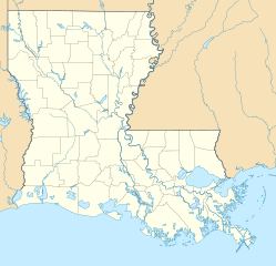
Quadratische Plattkarte, N-S-Streckung 120.0 %. Geographische Begrenzung der Karte:
Equirectangular projection, N/S stretching 120.0 %. Geographic limits of the map:
|
| Dáta | |
| Foinse | Obair féin |
| Údar | Alexrk2 |
| Leaganacha eile |
Derivative works of this file: |

|
This map has been made or improved in the German Kartenwerkstatt (Map Lab). You can propose maps to improve as well.
|
Ceadúnú
Is mise sealbhóir cóipchirt an shaothair seo agus foilsím é faoi na ceadúnais seo a leanas:

|
Tugtar cead an doiciméad seo a chóipeáil, a dháileadh agus/nó a mhodhnú faoi théarmaí an Ceadúnas Doiciméadúcháin Saor ó GNU, Leagan 1.2 nó aon leagan níos déanaí a d’fhoilsigh an Fondúireacht Bogearraí Saor in Aisce; gan aon Rannóga Inmheánacha, gan aon Téacsanna Clúdaigh Tosaigh, agus gan aon Téacsanna Clúdaigh Cúil. Tá cóip den cheadúnas san áireamh sa chuid dar teideal Ceadúnas Doiciméadúcháin Saor ó GNU. |
This file is licensed under the Creative Commons Attribution 3.0 Unported license.
- Is féidir:
- an saothar seo a roinnt – an saothar seo a chóipeáil, a dháil amach, agus a tharchur
- an saothar seo a athmheascadh – an saothar seo a oiriúnú
- Ach amháin má leantar na coinníollacha seo a leanas:
- sannadh – Ní mor creidiúint a thabhairt leis an saothar, faoi mar a shonraigh an údar nó tabharthóir an ceadúnais (ach ná húsáid modh a thugann le fios go thacaíonn sé/sí tú féin nó an úsáid a bhaineann tú as an saothar).
Is féidir leat a roghnú an ceadúnas do rogha
Stair chomhaid
Cliceáil ar dáta/am chun an comhad a radharc mar a bhí sé ag an am sin.
| Dáta/Am | Mionsamhail | Toisí | Úsáideoir | Nóta tráchta | |
|---|---|---|---|---|---|
| faoi láthair | 14:38, 7 Iúil 2009 | | 1,201 × 1,157 (811 KB) | Alexrk2 | == Beschreibung == {{Information |Description= {{de|Positionskarte von Louisiana, USA}} Quadratische Plattkarte, N-S-Streckung 120.0 %. Geographische Begrenzung der Karte: * N: 33.2° N * S: 28.7° N * W: 94.2° W * O: 88.6° |
Úsáid comhaid
Tá nasc chuig an gcomhad seo ar na leathanaigh seo a leanas:
Global file usage
The following other wikis use this file:
- Úsáid ar an.wikipedia.org
- Úsáid ar ar.wikipedia.org
- Úsáid ar ast.wikipedia.org
- Úsáid ar azb.wikipedia.org
- بووژر، لوئیزیانا
- باتونروژ، لوئیزیانا
- هوما، لوئیزیانا
- نووا آیبیریا، لوئیزیانا
- لیک چارلز، لوئیزیانا
- راستن، لوئیزیانا
- مارکسویل، لوئیزیانا
- الکساندریا، لوئیزیانا
- اسلایدل، لوئیزیانا
- ویدیلیا، لوئیزیانا
- منسفیلد، لوئیزیانا
- بیکر، لوئیزیانا
- نکیتاش، لوئیزیانا
- لافایت، لوئیزیانا
- منروو، لوئیزیانا
- قرامبلینق، لوئیزیانا
- نیو اورلئان دؤیوشو
- بلمانت، لوئیزیانا
- باکومویل، لوئیزیانا
- بایو قولا، لوئیزیانا
- سینت ماریس، لوئیزیانا
- دری، لوئیزیانا
- فیرویو آلفا، لوئیزیانا
- قرند اکور، لوئیزیانا
- کارلایل، لوئیزیانا
- لیک اند، لوئیزیانا
- فیشویل، لوئیزیانا
- چاپین، لوئیزیانا
- فلورا، لوئیزیانا
- اکمی، لوئیزیانا
- وردا، لوئیزیانا
- کرفت، لوئیزیانا
- پلژر بند، لوئیزیانا
- لیمنویل، لوئیزیانا
- اروینویل، لوئیزیانا
- لافورش کراسینق، لوئیزیانا
- مونشاین، لوئیزیانا
- پرسکیل، لوئیزیانا
- بایو کانتری کلاب، لوئیزیانا
- رومویل، لوئیزیانا
- وینا بند، لوئیزیانا
- بایو بلو، لوئیزیانا
- لاوتل، لوئیزیانا
View more global usage of this file.