
Íomhá:Saint-Denis map.svg

Size of this PNG preview of this SVG file: 587 × 600 picteilín. Other resolutions: 235 × 240 picteilín | 470 × 480 picteilín | 752 × 768 picteilín | 1,002 × 1,024 picteilín | 2,004 × 2,048 picteilín | 1,552 × 1,586 picteilín.
Taispeáin leagan ardtaifigh den íomhá (Comhad SVG, ainmniúil 1,552 × 1,586 picteilíni, méid comhaid: 540 KB)
| Seo comhad as An Cómhaoin Viciméid. Tá an tuairisc as an leathanach tuairisc Cómhaoin a leanas thíos.
|
Achoimriú
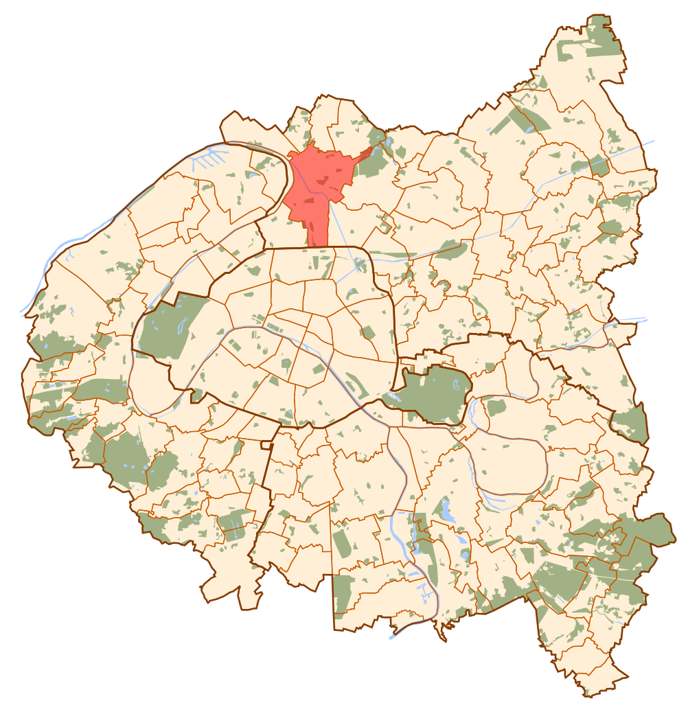
| Tuairisc | Map of Paris and its inner ring départements, localization of Saint-Denis (Author: Metropolitan). |
| Dáta | 10 Deireadh Fómhair 2006 (original upload date) |
| Foinse | No machine-readable source provided. Own work assumed (based on copyright claims). |
| Údar | No machine-readable author provided. Metropolitan~commonswiki assumed (based on copyright claims). |
Ceadúnú
| I, the copyright holder of this work, release this work into the public domain. This applies worldwide. In some countries this may not be legally possible; if so: I grant anyone the right to use this work for any purpose, without any conditions, unless such conditions are required by law. |
Stair chomhaid
Cliceáil ar dáta/am chun an comhad a radharc mar a bhí sé ag an am sin.
| Dáta/Am | Mionsamhail | Toisí | Úsáideoir | Nóta tráchta | |
|---|---|---|---|---|---|
| faoi láthair | 11:40, 10 Deireadh Fómhair 2006 | | 1,552 × 1,586 (540 KB) | Metropolitan~commonswiki | Map of Paris and its inner ring départements, localization of Saint-Denis (Author: Metropolitan). Category:Locator maps for municipalities of Seine-Saint-Denis |
Úsáid comhaid
Tá nasc chuig an gcomhad seo ar na leathanaigh seo a leanas:
Global file usage
The following other wikis use this file:
- Úsáid ar ar.wikipedia.org
- Úsáid ar arz.wikipedia.org
- Úsáid ar ast.wikipedia.org
- Úsáid ar ca.wikipedia.org
- Úsáid ar cs.wikipedia.org
- Úsáid ar da.wikipedia.org
- Úsáid ar de.wikipedia.org
- Úsáid ar diq.wikipedia.org
- Úsáid ar en.wikipedia.org
- Úsáid ar eo.wikipedia.org
- Úsáid ar es.wikipedia.org
- Úsáid ar eu.wikipedia.org
- Úsáid ar fa.wikipedia.org
- Úsáid ar fi.wikipedia.org
- Úsáid ar fr.wikipedia.org
- Úsáid ar fr.wikinews.org
- Úsáid ar gl.wikipedia.org
- Úsáid ar id.wikipedia.org
- Úsáid ar jv.wikipedia.org
- Úsáid ar la.wikipedia.org
- Úsáid ar lld.wikipedia.org
- Úsáid ar lv.wikipedia.org
- Úsáid ar mr.wikipedia.org
- Úsáid ar no.wikipedia.org
- Úsáid ar pl.wikipedia.org
- Úsáid ar pl.wikivoyage.org
- Úsáid ar pnb.wikipedia.org
- Úsáid ar pt.wikipedia.org
- Úsáid ar ro.wikipedia.org
- Úsáid ar sco.wikipedia.org
- Úsáid ar th.wikipedia.org
- Úsáid ar tt.wikipedia.org
- Úsáid ar ur.wikipedia.org
- Úsáid ar vi.wikipedia.org
- Úsáid ar www.wikidata.org