
Íomhá:OsakaMapCurrent.png
Size of this preview: 653 × 600 picteilín. Other resolutions: 261 × 240 picteilín | 523 × 480 picteilín | 981 × 901 picteilín.
Taispeáin leagan ardtaifigh den íomhá (981 × 901 picteilín, méid comhaid: 36 KB, cineál MIME: image/png)
| Seo comhad as An Cómhaoin Viciméid. Tá an tuairisc as an leathanach tuairisc Cómhaoin a leanas thíos.
|
Achoimriú
| Tuairisc |
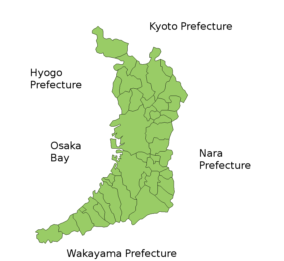
Map of Osaka Prefecture, Japan. Thanks to Aoki Shigenobu and [1]. Colors from Image:TokyoMapCurrent.png by User:Fg2. |
| Dáta | 19 Iúil 2006 (original upload date) |
| Foinse | No machine-readable source provided. Own work assumed (based on copyright claims). |
| Údar | No machine-readable author provided. Akanemoto~commonswiki assumed (based on copyright claims). |
Ceadúnú
| I, the copyright holder of this work, release this work into the public domain. This applies worldwide. In some countries this may not be legally possible; if so: I grant anyone the right to use this work for any purpose, without any conditions, unless such conditions are required by law. |
Stair chomhaid
Cliceáil ar dáta/am chun an comhad a radharc mar a bhí sé ag an am sin.
| Dáta/Am | Mionsamhail | Toisí | Úsáideoir | Nóta tráchta | |
|---|---|---|---|---|---|
| faoi láthair | 17:55, 19 Iúil 2006 | | 981 × 901 (36 KB) | Akanemoto~commonswiki | Map of Osaka Prefecture, Japan. Thanks to Aoki Shigenobu and [http://aoki2.si.gunma-u.ac.jp/map/map.html]. Colors from Image:TokyoMapCurrent.png by User:Fg2. Category:Maps of Osaka prefecture Category:Maps in English |
Úsáid comhaid
Níl nasc ó aon leathanach eile don íomhá seo.
Global file usage
The following other wikis use this file:
- Úsáid ar ast.wikipedia.org
- Úsáid ar az.wikipedia.org
- Úsáid ar ckb.wikipedia.org
- Úsáid ar cs.wikipedia.org
- Úsáid ar en.wikipedia.org
- Úsáid ar es.wikipedia.org
- Úsáid ar eu.wikipedia.org
- Úsáid ar fi.wikipedia.org
- Úsáid ar km.wikipedia.org
- Úsáid ar lt.wikipedia.org
- Úsáid ar no.wikipedia.org
- Úsáid ar ru.wikipedia.org
- Úsáid ar sco.wikipedia.org
- Úsáid ar simple.wikipedia.org