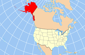
Íomhá:Map of USA AK full.png
Map_of_USA_AK_full.png (284 × 184 picteilín, méid comhaid: 19 KB, cineál MIME: image/png)
Stair chomhaid
Cliceáil ar dáta/am chun an comhad a radharc mar a bhí sé ag an am sin.
| Dáta/Am | Mionsamhail | Toisí | Úsáideoir | Nóta tráchta | |
|---|---|---|---|---|---|
| faoi láthair | 20:43, 17 Nollaig 2012 |  | 284 × 184 (19 KB) | Ras67 | cropped |
| 16:31, 2 Aibreán 2007 |  | 286 × 186 (20 KB) | MattWright | fix to more standard map colors | |
| 06:20, 2 Aibreán 2007 |  | 286 × 186 (19 KB) | MattWright | {{Information |Description=Map of USA with Alaska highlighted and shown in true position |Source=http://www.nationalatlas.gov/printable/reference.html |Date=2007-04-02 |Author= |Permission= |other_versions= }} Category:Maps of the United States [[Cat |
Úsáid comhaid
Tá nasc chuig an gcomhad seo ar 21 an leathanach seo a leanas:
- Buirg Aleutians Thoir, Alasca
- Buirg Anchorage, Alasca
- Buirg Artach Thiar Thuaidh, Alasca
- Buirg Bristol Bay, Alasca
- Buirg Denali, Alasca
- Buirg Fairbanks Réalta Thuaidh, Alasca
- Buirg Fána Taobh Thuaidh, Alasca
- Buirg Haines, Alasca
- Buirg Juneau, Alasca
- Buirg Leithinis Kenai, Alasca
- Buirg Loch agus Leithinis, Alasca
- Buirg Matanuska-Susitna, Alasca
- Buirg Neamheagraithe, Alasca
- Buirg Oileán Kodiak, Alasca
- Buirg Petersburg, Alasca
- Buirg Sitka, Alasca
- Buirg Skagway, Alasca
- Buirg Tairseach Ketchikan, Alasca
- Buirg Wrangell, Alasca
- Buirg Yakutat, Alasca
- Sitka
Global file usage
The following other wikis use this file:
- Úsáid ar am.wikipedia.org
- Úsáid ar ar.wikipedia.org
- Úsáid ar az.wikipedia.org
- Úsáid ar az.wiktionary.org
- Úsáid ar ba.wikipedia.org
- Úsáid ar bn.wikipedia.org
- Úsáid ar ce.wikipedia.org
- Úsáid ar cy.wikipedia.org
- Úsáid ar da.wikipedia.org
- Úsáid ar de.wikipedia.org
- Úsáid ar el.wikipedia.org
- Úsáid ar en.wikipedia.org
- Úsáid ar es.wikibooks.org
- Úsáid ar fa.wikipedia.org
- Úsáid ar fr.wikinews.org
- Úsáid ar he.wikipedia.org
- Úsáid ar hu.wikipedia.org
View more global usage of this file.


