
Íomhá:Map of State College, Centre County, Pennsylvania Highlighted.png
Taispeáin leagan ardtaifigh den íomhá (2,680 × 1,652 picteilín, méid comhaid: 79 KB, cineál MIME: image/png)
| Seo comhad as An Cómhaoin Viciméid. Tá an tuairisc as an leathanach tuairisc Cómhaoin a leanas thíos.
|
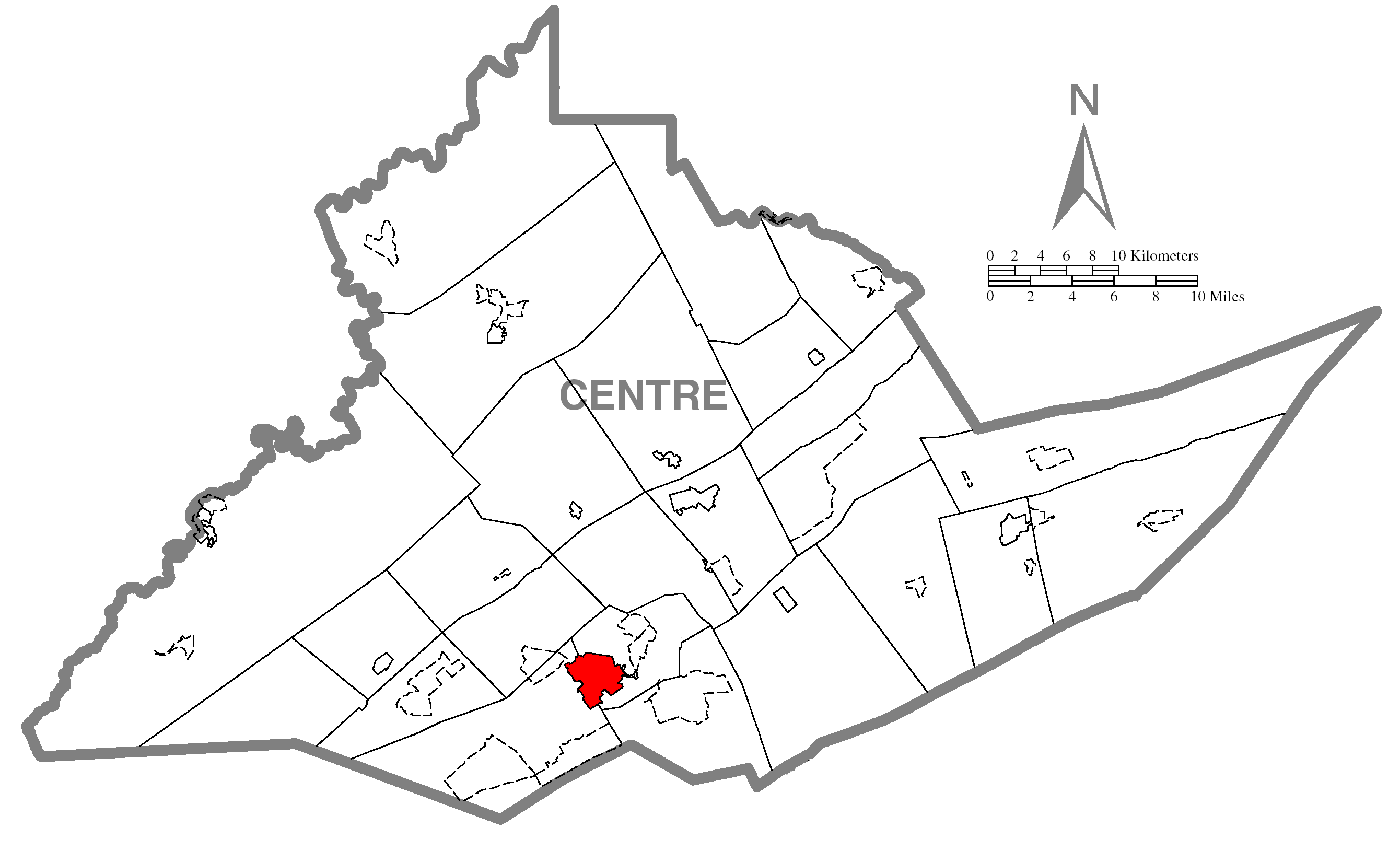
| Tuairisc | A map of Centre County showing State College, Pennsylvania (alternate) highlighted on the map. | |||
| Dáta | ||||
| Foinse | Source image taken from the United States Census Bureau's website pa_cosub.pdf. Image was modified by Ram-Man. | |||
| Údar | (c)2006 Derek Ramsey (Ram-Man) (from U.S. Census Bureau source) | |||
| Ceadúnas (Athúsáid a bhaint as an gcomhad seo) |
A United States Census Bureau / Government work is in the public domain, however, my modifications are licensed as follows: You may NOT use this image on your own web site or anywhere else unless you release this image and any derivative works (e.g. your web site) by following the terms of one of the following licenses. Any other use will be considered a breach of copyright and I reserve the right of legal action. If you have not read the terms of these licenses or do not understand them, then do not use this image. Is mise sealbhóir cóipchirt an shaothair seo agus foilsím é faoi na ceadúnais seo a leanas:
This file is licensed under the Creative Commons Attribution-Share Alike 2.5 Generic, 2.0 Generic and 1.0 Generic license.
Is féidir leat a roghnú an ceadúnas do rogha |
|||
| Leaganacha eile |
Image:Map of Centre County, Pennsylvania.png - Source map before highlighting (with text). Image:Map of Centre County, Pennsylvania No Text.png - Source map before highlighting (without text). |

Stair chomhaid
Cliceáil ar dáta/am chun an comhad a radharc mar a bhí sé ag an am sin.
| Dáta/Am | Mionsamhail | Toisí | Úsáideoir | Nóta tráchta | |
|---|---|---|---|---|---|
| faoi láthair | 17:03, 31 Deireadh Fómhair 2006 | | 2,680 × 1,652 (79 KB) | Ram-Man | {{Information| |Description={{PennMapDesc|Centre|State College}} |Source=Source image taken from the United States Census Bureau's website [http://www2.census.gov/geo/maps/general_ref/cousub_outline/cen2k_pgsz/pa_cosub.pdf pa_cosub.pdf]. Image was modifie |
Úsáid comhaid
Tá nasc chuig an gcomhad seo ar na leathanaigh seo a leanas:
Global file usage
The following other wikis use this file:
- Úsáid ar ar.wikipedia.org
- Úsáid ar azb.wikipedia.org
- Úsáid ar ca.wikipedia.org
- Úsáid ar cy.wikipedia.org
- Úsáid ar eu.wikipedia.org
- Úsáid ar fa.wikipedia.org
- Úsáid ar fr.wikipedia.org
- Úsáid ar ht.wikipedia.org
- Úsáid ar ja.wikipedia.org
- Úsáid ar sh.wikipedia.org
- Úsáid ar sr.wikipedia.org
- Úsáid ar tt.wikipedia.org
- Úsáid ar ur.wikipedia.org
- Úsáid ar vi.wikipedia.org
- Úsáid ar vo.wikipedia.org
- Úsáid ar www.wikidata.org
- Úsáid ar zh-min-nan.wikipedia.org
- Úsáid ar zh.wikipedia.org