
Íomhá:Kinrossmap1945.png
Size of this preview: 618 × 600 picteilín. Other resolutions: 247 × 240 picteilín | 494 × 480 picteilín | 961 × 933 picteilín.
Taispeáin leagan ardtaifigh den íomhá (961 × 933 picteilín, méid comhaid: 1.72 MB, cineál MIME: image/png)
| Seo comhad as An Cómhaoin Viciméid. Tá an tuairisc as an leathanach tuairisc Cómhaoin a leanas thíos.
|
This work is an Ordnance Survey map over 50 years old, which is covered by Crown Copyright which in this case expires 50 years after publication. Ordnance Survey does however ask that they be credited and that the date of publication be given.
Any ancillary rights gained through the creation of the electronic version are granted as freely usable under any circumstances.
|
This work created by the United Kingdom Government is in the public domain.
This is because it is one of the following:
HMSO has declared that the expiry of Crown Copyrights applies worldwide (ref: HMSO Email Reply)
|
 |
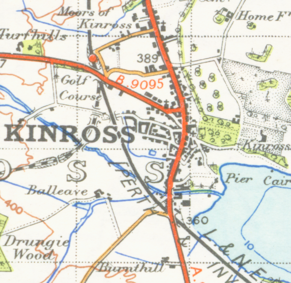
| Tuairisc | map of Kinross 1 inch to the mile scale scanned at 600 DPI |
| Dáta | |
| Foinse | OS map stirling and Dunfermline sheet 67 1945 |
| Údar | OS |
Stair chomhaid
Cliceáil ar dáta/am chun an comhad a radharc mar a bhí sé ag an am sin.
| Dáta/Am | Mionsamhail | Toisí | Úsáideoir | Nóta tráchta | |
|---|---|---|---|---|---|
| faoi láthair | 01:16, 24 Aibreán 2007 | | 961 × 933 (1.72 MB) | Geni | {{oldOS}} {{Information |Description=map of Kinross 1 inch to the mile scale scanned at 600 DPI |Source=OS map stirling and Dunfermline sheet 67 1945 |Date=1945 |Author=OS |Permission=none needed |other_versions= }} |
Úsáid comhaid
Níl nasc ó aon leathanach eile don íomhá seo.
Global file usage
The following other wikis use this file:
- Úsáid ar af.wikipedia.org
- Úsáid ar ceb.wikipedia.org
- Úsáid ar en.wikipedia.org
- Úsáid ar gd.wikipedia.org
- Úsáid ar it.wikipedia.org
- Úsáid ar sv.wikipedia.org