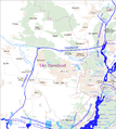
Íomhá:Karte Berlin Landnutzung.png

Page contents not supported in other languages.
Ón Vicipéid, an chiclipéid shaor.

Taispeáin leagan ardtaifigh den íomhá(10,361 × 8,336 picteilín, méid comhaid: 21.98 MB, cineál MIME: image/png)

Seo comhad as An Cómhaoin Viciméid. Tá an tuairisc as an leathanach tuairisc Cómhaoin a leanas thíos.
Is stór comhaid meáin Saor é an Cómhaoin Viciméid. Is féidir leat cabhrú.

Achoimriú

Warning The original file is very high-resolution. It might not load properly or could cause your browser to freeze when opened at full size.
Tuairisc
Deutsch: Karte Landnutzung Berlin
Dáta see file history
Foinse Obair féin using OpenStreetMap rendered with Maperitive
Údar Maximilian Dörrbecker (Chumwa)
Ceadúnas
(Athúsáid a bhaint as an gcomhad seo)
w:ga:Creative Commons
sannadh comhroinn araon
This file is licensed under the Creative Commons Attribution-Share Alike 2.0 Generic license.
Is féidir:
  • an saothar seo a roinnt – an saothar seo a chóipeáil, a dháil amach, agus a tharchur
  • an saothar seo a athmheascadh – an saothar seo a oiriúnú
Ach amháin má leantar na coinníollacha seo a leanas:
  • sannadh – Ní mor creidiúint a thabhairt leis an saothar, faoi mar a shonraigh an údar nó tabharthóir an ceadúnais (ach ná húsáid modh a thugann le fios go thacaíonn sé/sí tú féin nó an úsáid a bhaineann tú as an saothar).
  • comhroinn araon – Má athraíonn tú nó síneann tú amach an saothar seo, ní féidir é a dháileadh ach amhaín faoin gceadúnas céanna nó ceann cosúil leis an gceann seo.
This work contains information from OpenStreetMap, which is made available under the Open Database License (ODbL).

The ODbL does not require any particular license for maps produced from ODbL data. Prior to 1 August 2020, map tiles produced by the OpenStreetMap Foundation were licensed under the CC-BY-SA-2.0 license. Maps produced by other people may be subject to other licences.

Sie dürfen das Bild zu den folgenden Bedingungen nutzen:

  • Sie müssen den Namen des Autors nennen.
  • Im Falle einer Verbreitung müssen Sie anderen die Lizenzbedingungen, unter die dieses Bild fällt, mitteilen.
  • Sie müssen das Bild unter gleichen Bedingungen weitergeben. Wenn sie das Bild abändern oder Arbeiten auf diesem Bild aufbauen, müssen Sie das Ergebnis aus dieser Arbeit ebenfalls unter diese Lizenz stellen.
  • Jede dieser Bedingungen kann nach schriftlicher Einwilligung des Rechtsinhabers aufgehoben werden.
Leaganacha eile
This city map image could be re-created using vector graphics as an SVG file. This has several advantages; see Commons:Media for cleanup for more information. If an SVG form of this image is available, please upload it and afterwards replace this template with {{vector version available|new image name}}.


It is recommended to name the SVG file “Karte Berlin Landnutzung.svg”—then the template Vector version available (or Vva) does not need the new image name parameter.

Captions

Add a one-line explanation of what this file represents

Items portrayed in this file

taispeánann sé/sí

Stair chomhaid

Cliceáil ar dáta/am chun an comhad a radharc mar a bhí sé ag an am sin.

Dáta/AmMionsamhailToisíÚsáideoirNóta tráchta
faoi láthair19:15, 31 Lúnasa 2014Mionsamhail do leagan ó 19:15, 31 Lúnasa 201410,361 × 8,336 (21.98 MB)Chumwa== {{int:filedesc}} == {{Information |Description = {{de|1=Karte Landnutzung Berlin}} |Source={{own}} using OpenStreetMap rendered with [http://maperitive.net/ Maperitive] |Date = see file history |Author = [[:de:User:Chumwa|Maxi...

Tá nasc chuig an gcomhad seo ar na leathanaigh seo a leanas:

Global file usage

The following other wikis use this file:

Meiteasonraí