
Íomhá:Haifa Israel Map.png
Níl aon taifeach is mó ar fáil.
Haifa_Israel_Map.png (285 × 275 picteilín, méid comhaid: 15 KB, cineál MIME: image/png)
| Seo comhad as An Cómhaoin Viciméid. Tá an tuairisc as an leathanach tuairisc Cómhaoin a leanas thíos.
|
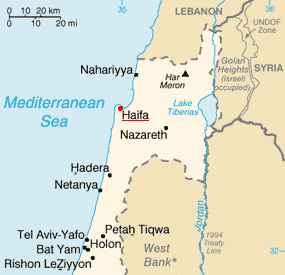
| Tuairisc | Haifa on the map of Israel | |||
| Dáta | ||||
| Foinse | Image:Is-map.PNG | |||
| Údar | PeteCS | |||
| Ceadúnas (Athúsáid a bhaint as an gcomhad seo) |
|

Stair chomhaid
Cliceáil ar dáta/am chun an comhad a radharc mar a bhí sé ag an am sin.
| Dáta/Am | Mionsamhail | Toisí | Úsáideoir | Nóta tráchta | |
|---|---|---|---|---|---|
| faoi láthair | 09:38, 18 Feabhra 2007 | | 285 × 275 (15 KB) | PeteCS | {{Information |Description=Haifa on the map of Israel |Source=Image:Is-map.PNG |Date=18-02-2007 |Author=~~~ |Permission={{PD-USGov-CIA-WF}} |other_versions=jiné verze }} Category:Haifa |
Úsáid comhaid
Níl nasc ó aon leathanach eile don íomhá seo.
Global file usage
The following other wikis use this file: