
Íomhá:GulfofMexico3D.jpg

Size of this preview: 734 × 600 picteilín. Other resolutions: 294 × 240 picteilín | 588 × 480 picteilín | 940 × 768 picteilín | 1,253 × 1,024 picteilín | 2,507 × 2,048 picteilín | 3,000 × 2,451 picteilín.
Taispeáin leagan ardtaifigh den íomhá (3,000 × 2,451 picteilín, méid comhaid: 508 KB, cineál MIME: image/jpeg)
| Seo comhad as An Cómhaoin Viciméid. Tá an tuairisc as an leathanach tuairisc Cómhaoin a leanas thíos.
|
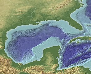
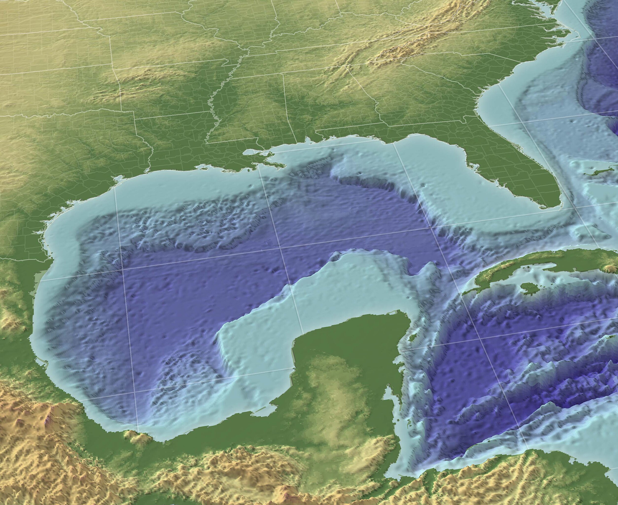
"The Gulf of Mexico in 3D perspective. A GIS can create very accurate and realistic-looking environments." Source (High-Res: 3000x2451).
This image is in the public domain because it contains materials that originally came from the U.S. National Oceanic and Atmospheric Administration, taken or made as part of an employee's official duties.
|
From English wikipedia w:en:Image:GulfofMexico3D.png
Stair chomhaid
Cliceáil ar dáta/am chun an comhad a radharc mar a bhí sé ag an am sin.
| Dáta/Am | Mionsamhail | Toisí | Úsáideoir | Nóta tráchta | |
|---|---|---|---|---|---|
| faoi láthair | 10:30, 13 Samhain 2009 | | 3,000 × 2,451 (508 KB) | Justass | resolution |
| 18:36, 19 Bealtaine 2005 |  | 1,024 × 837 (545 KB) | Gengiskanhg | "The Gulf of Mexico in 3D perspective. A GIS can create very accurate and realistic-looking environments." [http://oceanexplorer.noaa.gov/technology/tools/mapping/media/GulfofMexico.jpg Source] (High-Res: 3000x2451). {{PD-USGov-NOAA}} From US wikipedia |
Úsáid comhaid
Níl nasc ó aon leathanach eile don íomhá seo.
Global file usage
The following other wikis use this file:
- Úsáid ar af.wikipedia.org
- Úsáid ar an.wikipedia.org
- Úsáid ar ar.wikipedia.org
- Úsáid ar ast.wikipedia.org
- Úsáid ar avk.wikipedia.org
- Úsáid ar azb.wikipedia.org
- Úsáid ar az.wikipedia.org
- Úsáid ar az.wiktionary.org
- Úsáid ar ba.wikipedia.org
- Úsáid ar be-tarask.wikipedia.org
- Úsáid ar be.wikipedia.org
- Úsáid ar br.wikipedia.org
- Úsáid ar bs.wikipedia.org
- Úsáid ar ca.wikipedia.org
- Úsáid ar ce.wikipedia.org
- Úsáid ar cs.wikipedia.org
- Úsáid ar cv.wikipedia.org
- Úsáid ar cy.wikipedia.org
- Úsáid ar da.wikipedia.org
- Úsáid ar de.wikipedia.org
- Úsáid ar en.wikipedia.org
- Úsáid ar en.wikibooks.org
- Úsáid ar en.wikinews.org
- Úsáid ar en.wiktionary.org
- Úsáid ar eo.wikipedia.org
- Úsáid ar es.wikipedia.org
View more global usage of this file.