
Íomhá:Flags of convenience.png
Size of this preview: 800 × 406 picteilín. Other resolutions: 320 × 162 picteilín | 640 × 325 picteilín | 1,024 × 519 picteilín | 1,280 × 649 picteilín | 4,000 × 2,029 picteilín.
Taispeáin leagan ardtaifigh den íomhá (4,000 × 2,029 picteilín, méid comhaid: 723 KB, cineál MIME: image/png)
| Seo comhad as An Cómhaoin Viciméid. Tá an tuairisc as an leathanach tuairisc Cómhaoin a leanas thíos.
|

|
This file requires updating. In doing so, you could add a timestamp to the file.
|
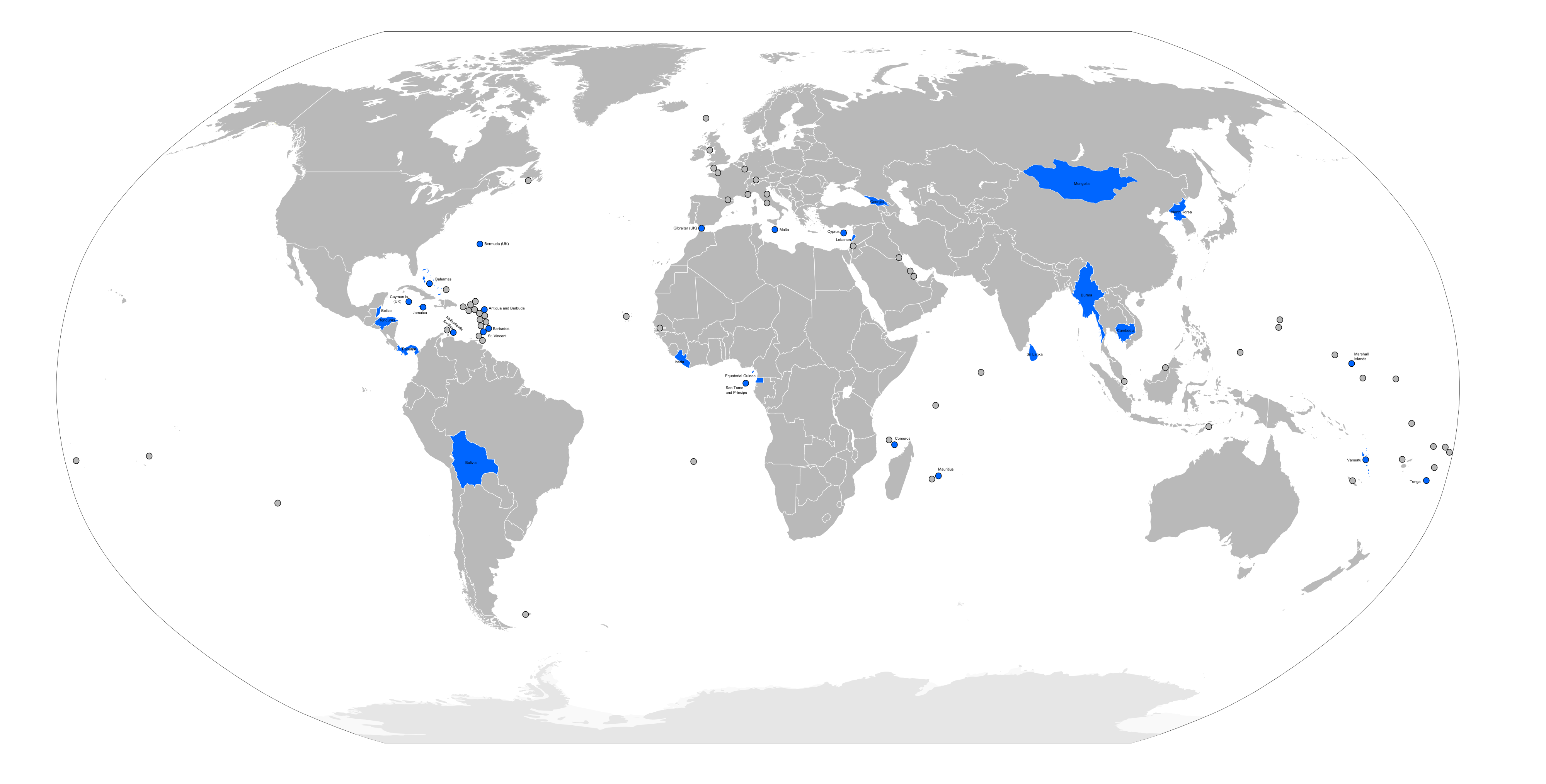
| Tuairisc | Flags of convenience countries and territories (marked in blue), as listed by the w:International Transport Workers' Federation on [1] |
| Dáta | |
| Foinse | self-made from Image:BlankMap-World6.svg |
| Údar | self |
Is mise sealbhóir cóipchirt an shaothair seo agus foilsím é faoi na ceadúnais seo a leanas:

|
Tugtar cead an doiciméad seo a chóipeáil, a dháileadh agus/nó a mhodhnú faoi théarmaí an Ceadúnas Doiciméadúcháin Saor ó GNU, Leagan 1.2 nó aon leagan níos déanaí a d’fhoilsigh an Fondúireacht Bogearraí Saor in Aisce; gan aon Rannóga Inmheánacha, gan aon Téacsanna Clúdaigh Tosaigh, agus gan aon Téacsanna Clúdaigh Cúil. Tá cóip den cheadúnas san áireamh sa chuid dar teideal Ceadúnas Doiciméadúcháin Saor ó GNU. |
| This file is licensed under the Creative Commons Attribution-Share Alike 3.0 Unported license. | ||
| ||
| This licensing tag was added to this file as part of the GFDL licensing update. |
Is féidir leat a roghnú an ceadúnas do rogha
Stair chomhaid
Cliceáil ar dáta/am chun an comhad a radharc mar a bhí sé ag an am sin.
| Dáta/Am | Mionsamhail | Toisí | Úsáideoir | Nóta tráchta | |
|---|---|---|---|---|---|
| faoi láthair | 09:51, 26 Deireadh Fómhair 2008 | | 4,000 × 2,029 (723 KB) | RaviC | fixed. cayman islands are part of U.K (British overseas territory) |
| 02:29, 2 Aibreán 2008 |  | 4,000 × 2,029 (623 KB) | Hoshie | fixed map. Aruba is not part of the Neth. Anilles; the Marshall Islands are a independent country like Germany, France, Britain, etc. | |
| 22:15, 25 Meitheamh 2007 |  | 4,000 × 2,029 (738 KB) | Roke~commonswiki | ||
| 09:32, 24 Bealtaine 2007 |  | 4,000 × 2,029 (921 KB) | Roke~commonswiki | {{Information |Description= Flags of convenience countries and territories, as listed by the w:International Transport Workers' Federation on [http://www.itfglobal.org/flags-convenience/flags-convenien-183.cfm] |Source=self-made from [[:Image:BlankMa |
Úsáid comhaid
Tá nasc chuig an gcomhad seo ar na leathanaigh seo a leanas:
Global file usage
The following other wikis use this file:
- Úsáid ar da.wikipedia.org
- Úsáid ar en.wikipedia.org
- Úsáid ar et.wikipedia.org
- Úsáid ar fa.wikipedia.org
- Úsáid ar hr.wikipedia.org
- Úsáid ar id.wikipedia.org
- Úsáid ar it.wikipedia.org
- Úsáid ar nl.wikipedia.org
- Úsáid ar pl.wikipedia.org