Íomhá:Comparison satellite navigation orbits.svg

Page contents not supported in other languages.
Ón Vicipéid, an chiclipéid shaor.

Taispeáin leagan ardtaifigh den íomhá(Comhad SVG, ainmniúil 512 × 512 picteilíni, méid comhaid: 42 KB)

Render this image in .
Seo comhad as An Cómhaoin Viciméid. Tá an tuairisc as an leathanach tuairisc Cómhaoin a leanas thíos.
Is stór comhaid meáin Saor é an Cómhaoin Viciméid. Is féidir leat cabhrú.
This image is an animated SVG file. The .png preview above created by RSVG for use in Wikimedia is not animated and may be incomplete or incorrect. To see the animation, open media:Comparison satellite navigation orbits.svg. It should run in any modern browser or viewer. Recent versions of Chrome, Firefox, Microsoft Edge, Safari, and Opera all support SVG animated with SMIL. Other SVG animations can be found at Category:Animated SVG files.

Templates:Animated SVG/I18n
العربية | Boarisch | বাংলা | català | čeština | Deutsch | Deutsch (Sie-Form)‎ | English | español | فارسی | suomi | français | galego | עברית | हिन्दी | magyar | հայերեն | íslenska | italiano | 日本語 | 한국어 | lietuvių | македонски | മലയാളം | Plattdüütsch | Nederlands | occitan | português | português do Brasil | русский | sicilianu | slovenščina | svenska | ไทย | українська | 中文 | 中文(简体)‎ | 中文(繁體)‎ | +/−

Achoimriú

Tuairisc
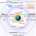
English: Comparison of GPS, GLONASS, Galileo and COMPASS (medium Earth orbit satellites) orbits with International Space Station, Hubble Space Telescope, geostationary and graveyard orbits, and the nominal size of the Earth.


For this diagram, the 3-dimensional aspect of orbits have been flattened. For instance, the view of the Earth depicted is looking down to the North Pole which makes the orbit representations appear to be equatorial. While this is accurate for geostationary orbits, other orbits listed are actually at significant inclinations. The inclination of Iridium orbits is at 86.4° which is nearly perpendicular to the diagrammed plane. Looking down to the North Pole from this zenith, a polar orbit of 90° inclination would actually appear as a straight line.
Français : Comparaison des orbites GPS, GLONASS, Galileo, Iridium et Beidou avec celles de la Station spatiale internationale et Hubble ainsi que l'orbite géostationnaire, l'orbite de rebut et la taille de la Terre.


Pour ce diagramme, l'aspect tridimensionnel des orbites a été ignoré : tout est aplati. La Terre est représentée avec le pôle Nord au centre, ce qui fait que les orbites semblent équatoriales. Ceci est correct dans le cas des orbites géostationnaires, mais les autres sont en réalité inclinées. Les satellites Iridium sont le cas le plus extrême, avec 86,4° d'inclinaison, les plaçant presque à la perpendiculaire du plan représenté. Si leur orbite était représentée de façon fidèle, nous ne verrions qu'une ligne droite sur ce diagramme.
Foinse Obair féin
Údar cmglee
Leaganacha eile

[cuir in eagar]

English: Animated
Español: Animada
Македонски: Анимирано
Русский: Мультипликация
Українська: Анімація
English: Static
Македонски: Обична слика
Русский: Обычная картинка
Українська: Статичне зображення
SVG genesis
InfoField
 
The SVG code is valid.
 
This diagram was created with unknown tool.
 
 This diagram is translated using SVG switch elements: all translations are stored in the same file.

Assessment

Media of the day This file was selected as the media of the day for 12 August 2020. It was captioned as follows:
English: A detailed and informative diagram that brings to life where different satellites (e.g. the International Space Station vs. the GPS satellites) are physically located relative to Earth
Other languages
Čeština: Detailní diagram ukazující, kde se na oběžné dráze kolem Země fyzicky nacházejí různé uměle vyrobené satelity, např. Mezinárodní vesmírná stanice nebo součásti sysému GPS.
English: A detailed and informative diagram that brings to life where different satellites (e.g. the International Space Station vs. the GPS satellites) are physically located relative to Earth
Français : Diagramme animé présentant les principales orbites des satellites artificiels autour de la Terre.

Featured media
This is a featured media on Wikimedia Commons and is considered one of the finest files.

If you have a file of similar quality that can be published under a suitable copyright license, be sure to upload it, tag it, and nominate it.

an Vicipéid

 This is a featured picture on the English language Wikipedia (Featured pictures) and is considered one of the finest images. See its nomination here.

If you think this file should be featured on Wikimedia Commons as well, feel free to nominate it.
If you have an image of similar quality that can be published under a suitable copyright license, be sure to upload it, tag it, and nominate it.

Ceadúnú

Is mise sealbhóir cóipchirt an shaothair seo agus foilsím é faoi na ceadúnais seo a leanas:
w:ga:Creative Commons
sannadh comhroinn araon
This file is licensed under the Creative Commons Attribution-Share Alike 3.0 Unported license.
Is féidir:
  • an saothar seo a roinnt – an saothar seo a chóipeáil, a dháil amach, agus a tharchur
  • an saothar seo a athmheascadh – an saothar seo a oiriúnú
Ach amháin má leantar na coinníollacha seo a leanas:
  • sannadh – Ní mor creidiúint a thabhairt leis an saothar, faoi mar a shonraigh an údar nó tabharthóir an ceadúnais (ach ná húsáid modh a thugann le fios go thacaíonn sé/sí tú féin nó an úsáid a bhaineann tú as an saothar).
  • comhroinn araon – Má athraíonn tú nó síneann tú amach an saothar seo, ní féidir é a dháileadh ach amhaín faoin gceadúnas céanna nó ceann cosúil leis an gceann seo.
GNU head Tugtar cead an doiciméad seo a chóipeáil, a dháileadh agus/nó a mhodhnú faoi théarmaí an Ceadúnas Doiciméadúcháin Saor ó GNU, Leagan 1.2 nó aon leagan níos déanaí a d’fhoilsigh an Fondúireacht Bogearraí Saor in Aisce; gan aon Rannóga Inmheánacha, gan aon Téacsanna Clúdaigh Tosaigh, agus gan aon Téacsanna Clúdaigh Cúil. Tá cóip den cheadúnas san áireamh sa chuid dar teideal Ceadúnas Doiciméadúcháin Saor ó GNU.
Is féidir leat a roghnú an ceadúnas do rogha
Annotations
InfoField
This image is annotated: View the annotations at Commons

Captions

Add a one-line explanation of what this file represents
Earth satellite orbits

MIME type Béarla

image/svg+xml

checksum Béarla

2cf5d382b563a0eac7ecd7322d221f0fb0d6bbbb

determination method Béarla: SHA-1 Béarla

data size Béarla

43,502 Beart

512 picteilín

512 picteilín

Stair chomhaid

Cliceáil ar dáta/am chun an comhad a radharc mar a bhí sé ag an am sin.

(An ceann is déanaí | An ceann is luaithe) Taispeáin (10 níos nuaí | ) (10 | 20 | 50 | 100 | 250 | 500).
Dáta/AmMionsamhailToisíÚsáideoirNóta tráchta
faoi láthair04:48, 27 Feabhra 2021Mionsamhail do leagan ó 04:48, 27 Feabhra 2021512 × 512 (42 KB)GlrxFix SVG errors: systemLanguage attr on desc element; misuse of switch element; use SVG 2.0 rules; delete DOCTYPE
14:49, 24 Meán Fómhair 2020Mionsamhail do leagan ó 14:49, 24 Meán Fómhair 2020512 × 512 (43 KB)DrhymeFile uploaded using svgtranslate tool (https://svgtranslate.toolforge.org/). Added translation for ko.
14:44, 24 Meán Fómhair 2020Mionsamhail do leagan ó 14:44, 24 Meán Fómhair 2020512 × 512 (40 KB)DrhymeFile uploaded using svgtranslate tool (https://svgtranslate.toolforge.org/). Added translation for ko.
14:35, 24 Meán Fómhair 2020Mionsamhail do leagan ó 14:35, 24 Meán Fómhair 2020512 × 512 (36 KB)DrhymeFile uploaded using svgtranslate tool (https://svgtranslate.toolforge.org/). Added translation for ko.
19:41, 22 Meán Fómhair 2020Mionsamhail do leagan ó 19:41, 22 Meán Fómhair 2020512 × 512 (29 KB)CmgleeReverted to version as of 18:10, 19 August 2020 (UTC) as text is now misaligned and descriptions are removed
11:31, 21 Meán Fómhair 2020Mionsamhail do leagan ó 11:31, 21 Meán Fómhair 2020512 × 512 (23 KB)Leonel SohnsValid SVG.
18:10, 19 Lúnasa 2020Mionsamhail do leagan ó 18:10, 19 Lúnasa 2020512 × 512 (29 KB)RavenpuffSpecify supplementary systemLanguage="en" in switch tags as per Commons guidance
01:11, 19 Lúnasa 2020Mionsamhail do leagan ó 01:11, 19 Lúnasa 2020512 × 512 (25 KB)CmgleeFix broken hover effects and redundant text.
17:55, 30 Meitheamh 2020Mionsamhail do leagan ó 17:55, 30 Meitheamh 2020512 × 512 (33 KB)Galaktoschange http: to https: (except in doctype or xmlns) and wikipedia.org to en.wikipedia.org
19:43, 23 Meitheamh 2020Mionsamhail do leagan ó 19:43, 23 Meitheamh 2020512 × 512 (33 KB)CmgleeTry again
(An ceann is déanaí | An ceann is luaithe) Taispeáin (10 níos nuaí | ) (10 | 20 | 50 | 100 | 250 | 500).

Tá nasc chuig an gcomhad seo ar na leathanaigh seo a leanas:

Global file usage

The following other wikis use this file:

View more global usage of this file.
Meiteasonraí