
Íomhá:Brunswick Park Road - geograph.org.uk - 1512096.jpg
Níl aon taifeach is mó ar fáil.
Brunswick_Park_Road_-_geograph.org.uk_-_1512096.jpg (640 × 407 picteilín, méid comhaid: 204 KB, cineál MIME: image/jpeg)
| Seo comhad as An Cómhaoin Viciméid. Tá an tuairisc as an leathanach tuairisc Cómhaoin a leanas thíos.
|
Achoimriú
| Tuairisc |
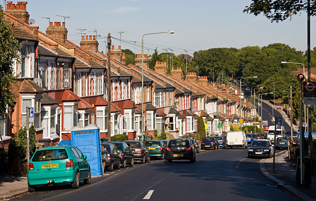
English: Brunswick Park Road The road descends into a valley that was probably created by a tributary of Pymmes Brook - the stream on the North Middlesex Golf Course seems a likely candidate.
At the bottom it passes New Southgate Recreation Ground before climbing again to a summit beside New Southgate Cemetery, hidden in the trees on the horizon. |
| Dáta | |
| Foinse | From geograph.org.uk |
| Údar | Martin Addison |
| Creidiúint (required by the license) | Martin Addison / Brunswick Park Road / |
| Camera location | | View this and other nearby images on: OpenStreetMap |
|---|
_heading:337.00&language=ga)
| Object location | | View this and other nearby images on: OpenStreetMap |
|---|
_heading:337.00&language=ga)
Ceadúnú

|
This image was taken from the Geograph project collection. See this photograph's page on the Geograph website for the photographer's contact details. The copyright on this image is owned by Martin Addison and is licensed for reuse under the Creative Commons Attribution-ShareAlike 2.0 license.
|
This file is licensed under the Creative Commons Attribution-Share Alike 2.0 Generic license.
Creidiúint: Martin Addison
- Is féidir:
- an saothar seo a roinnt – an saothar seo a chóipeáil, a dháil amach, agus a tharchur
- an saothar seo a athmheascadh – an saothar seo a oiriúnú
- Ach amháin má leantar na coinníollacha seo a leanas:
- sannadh – Ní mor creidiúint a thabhairt leis an saothar, faoi mar a shonraigh an údar nó tabharthóir an ceadúnais (ach ná húsáid modh a thugann le fios go thacaíonn sé/sí tú féin nó an úsáid a bhaineann tú as an saothar).
- comhroinn araon – Má athraíonn tú nó síneann tú amach an saothar seo, ní féidir é a dháileadh ach amhaín faoin gceadúnas céanna nó ceann cosúil leis an gceann seo.
Stair chomhaid
Cliceáil ar dáta/am chun an comhad a radharc mar a bhí sé ag an am sin.
| Dáta/Am | Mionsamhail | Toisí | Úsáideoir | Nóta tráchta | |
|---|---|---|---|---|---|
| faoi láthair | 23:33, 2 Márta 2011 | | 640 × 407 (204 KB) | GeographBot | == {{int:filedesc}} == {{Information |description={{en|1=Brunswick Park Road The road descends into a valley that was probably created by a tributary of Pymmes Brook - the stream on the North Middlesex Golf Course seems a likely candidate. At the botto |
Úsáid comhaid
Tá nasc chuig an gcomhad seo ar na leathanaigh seo a leanas:
Global file usage
The following other wikis use this file:
- Úsáid ar en.wikipedia.org
- Úsáid ar no.wikipedia.org
- Úsáid ar www.wikidata.org