
Íomhá:Annadales Historical Map.png
Níl aon taifeach is mó ar fáil.
Annadales_Historical_Map.png (368 × 456 picteilín, méid comhaid: 16 KB, cineál MIME: image/png)
| Seo comhad as An Cómhaoin Viciméid. Tá an tuairisc as an leathanach tuairisc Cómhaoin a leanas thíos.
|
Achoimriú
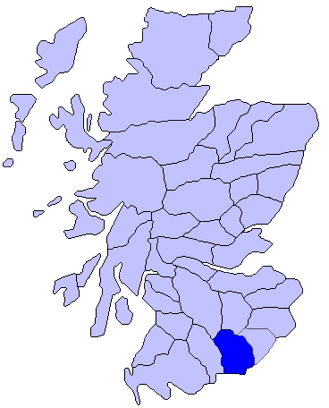
| Tuairisc | Map of Annadales Historical Location |
| Dáta | |
| Foinse | Using Paint.net |
| Údar | Comradcaer |
Ceadúnú
| This file is made available under the Creative Commons CC0 1.0 Universal Public Domain Dedication. | |
| The person who associated a work with this deed has dedicated the work to the public domain by waiving all of their rights to the work worldwide under copyright law, including all related and neighboring rights, to the extent allowed by law. You can copy, modify, distribute and perform the work, even for commercial purposes, all without asking permission.
|
Original upload log
The original description page was here. All following user names refer to en.wikipedia.
| Dáta/Am | Toisí | Úsáideoir | Nóta tráchta |
|---|---|---|---|
| 2014-10-28 00:44:38 | 368× 456× | Comradcaer | Uploading a self-made file using [[Wikipedia:File_Upload_Wizard|File Upload Wizard]] |
Stair chomhaid
Cliceáil ar dáta/am chun an comhad a radharc mar a bhí sé ag an am sin.
| Dáta/Am | Mionsamhail | Toisí | Úsáideoir | Nóta tráchta | |
|---|---|---|---|---|---|
| faoi láthair | 08:55, 27 Nollaig 2016 | | 368 × 456 (16 KB) | FastilyClone | Transferred from en.wikipedia (MTC!) |
Úsáid comhaid
Tá nasc chuig an gcomhad seo ar na leathanaigh seo a leanas:
Global file usage
The following other wikis use this file:
- Úsáid ar en.wikipedia.org
- Úsáid ar es.wikipedia.org
- Úsáid ar it.wikipedia.org
- Úsáid ar pt.wikipedia.org
- Úsáid ar uk.wikipedia.org
- Úsáid ar www.wikidata.org