
Íomhá:1922 Berbera detail Map of Africa and Adjoining Portions of Europe and Asia by US National Geographic Society BPL m0612013.png

Size of this preview: 800 × 546 picteilín. Other resolutions: 320 × 218 picteilín | 640 × 437 picteilín | 1,067 × 728 picteilín.
Taispeáin leagan ardtaifigh den íomhá (1,067 × 728 picteilín, méid comhaid: 1.58 MB, cineál MIME: image/png)
| Seo comhad as An Cómhaoin Viciméid. Tá an tuairisc as an leathanach tuairisc Cómhaoin a leanas thíos.
|
| Tuairisc |
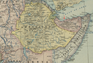
Detail of: Map of Africa and Adjoining Portions of Europe and Asia Author: National Geographic Society (U.S.) Publisher: National Geographic Society (U.S.) Date: 1922 Scale: 1:11,500,000 |
| Dáta | |
| Foinse | Boston Public Library, Map Center (Boston, Massachusetts, USA) / http://maps.bpl.org/id/m0612013 |
| Údar | National Geographic Society (U.S.) |
I Stáit Aontaithe Mheiriceá, tá an chomhad méide seo sa bhfearann poiblí. Ciallaíonn sé seo go bhfoilsíodh don chéad uair an íomhá seo i Stáit Aontaithe Meiriceá roimh an 1 Eanáir 1929. Féach ar an leathanach seo le tuilleadh eolais.
|
 | |
 |
B'fhéidir go bhfuil rialacha eile i bhfeidhm i limistéir údaráis eile, agus b'fhéidir nach bhfuil an íomhá seo sa bhfearann poiblí lasmuigh de Stáit Aontaithe Mhericeá.
|
Stair chomhaid
Cliceáil ar dáta/am chun an comhad a radharc mar a bhí sé ag an am sin.
| Dáta/Am | Mionsamhail | Toisí | Úsáideoir | Nóta tráchta | |
|---|---|---|---|---|---|
| faoi láthair | 15:54, 18 Feabhra 2013 | | 1,067 × 728 (1.58 MB) | M2545 | {{Information |Description=Detail of: Map of Africa and Adjoining Portions of Europe and Asia Author: National Geographic Society (U.S.) Publisher: National Geographic Society (U.S.) Date: 1922 Scale: 1:11,500,000 |Source=Boston Public Library, Ma... |
Úsáid comhaid
Tá nasc chuig an gcomhad seo ar na leathanaigh seo a leanas:
Global file usage
The following other wikis use this file:
- Úsáid ar en.wikipedia.org
- Úsáid ar fi.wikipedia.org
- Úsáid ar ko.wikipedia.org
- Úsáid ar simple.wikipedia.org