
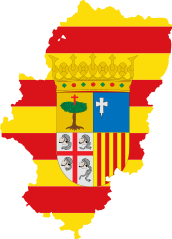
Íomhá:Flag map of Aragón.svg

Size of this PNG preview of this SVG file: 115 × 160 picteilín. Other resolutions: 172 × 240 picteilín | 345 × 480 picteilín | 552 × 768 picteilín | 736 × 1,024 picteilín | 1,472 × 2,048 picteilín.
Taispeáin leagan ardtaifigh den íomhá (Comhad SVG, ainmniúil 115 × 160 picteilíni, méid comhaid: 212 KB)
| Seo comhad as An Cómhaoin Viciméid. Tá an tuairisc as an leathanach tuairisc Cómhaoin a leanas thíos.
|
| Tuairisc | Flag map of Aragon |
| Dáta | (UTC) |
| Foinse | |
| Údar |
|
This file is licensed under the Creative Commons Attribution-Share Alike 3.0 Unported license.
- Is féidir:
- an saothar seo a roinnt – an saothar seo a chóipeáil, a dháil amach, agus a tharchur
- an saothar seo a athmheascadh – an saothar seo a oiriúnú
- Ach amháin má leantar na coinníollacha seo a leanas:
- sannadh – Ní mor creidiúint a thabhairt leis an saothar, faoi mar a shonraigh an údar nó tabharthóir an ceadúnais (ach ná húsáid modh a thugann le fios go thacaíonn sé/sí tú féin nó an úsáid a bhaineann tú as an saothar).
- comhroinn araon – Má athraíonn tú nó síneann tú amach an saothar seo, ní féidir é a dháileadh ach amhaín faoin gceadúnas céanna nó ceann cosúil leis an gceann seo.
Uploaded with derivativeFX
Stair chomhaid
Cliceáil ar dáta/am chun an comhad a radharc mar a bhí sé ag an am sin.
| Dáta/Am | Mionsamhail | Toisí | Úsáideoir | Nóta tráchta | |
|---|---|---|---|---|---|
| faoi láthair | 21:36, 1 Aibreán 2011 | | 115 × 160 (212 KB) | Fry1989 | {{Information |Description=Flag map of Aragon |Source=*File:Localización_de_Aragón.svg *File:Flag_of_Aragon.svg |Date=2011-04-01 21:28 (UTC) |Author=*File:Localización_de_Aragón.svg: Mutxamel, subido por '''[[User:R |
Úsáid comhaid
Tá nasc chuig an gcomhad seo ar na leathanaigh seo a leanas:
Global file usage
The following other wikis use this file:
- Úsáid ar bs.wikipedia.org
- Úsáid ar en.wikipedia.org
- Aragón (river)
- Tamarite de Litera
- Valderrobres
- Sesa, Spain
- Benasque
- La Litera
- Crivillén
- Biota, Cinco Villas
- Manzanera
- Villanúa
- Abiego
- Atea, Zaragoza
- Biel, Aragon
- Terrer
- Figueruelas
- Monte Perdido
- Segeda
- Foz-Calanda
- Monforte de Moyuela
- Fuenferrada
- Chía, Aragon
- Orés
- Template:Aragon-geo-stub
- Belchite
- Berge, Teruel
- Campo, Aragon
- Cariñena, Aragon
- Mallos de Riglos
- Collarada
- Ibieca
- Noguera Ribagorçana
- Montalbán, Teruel
- Andorra, Teruel
- Pancrudo
- La Puebla de Híjar
- Mozota
- Tolva
- Tena Valley
- Épila
- Balaïtous
- Calanda, Spain
- El Montsec d'Ares
- Berrueco
- Gallur
- Used, Huesca
- Murero
- High Aragon
- Cadrete
- Aínsa
View more global usage of this file.