
Íomhá:US 101.svg

Size of this PNG preview of this SVG file: 750 × 600 picteilín. Other resolutions: 300 × 240 picteilín | 600 × 480 picteilín | 960 × 768 picteilín | 1,280 × 1,024 picteilín | 2,560 × 2,048 picteilín.
Taispeáin leagan ardtaifigh den íomhá (Comhad SVG, ainmniúil 750 × 600 picteilíni, méid comhaid: 4 KB)
| Seo comhad as An Cómhaoin Viciméid. Tá an tuairisc as an leathanach tuairisc Cómhaoin a leanas thíos.
|
Achoimriú
| Tuairisc |
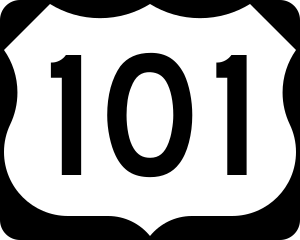
English: 750 mm × 600 mm (30 in × 24 in) U.S. Highway shield, made to the specifications of the 2004 edition of Standard Highway Signs. (Note that there is a missing "J" label on the left side of the diagram.) Uses the Roadgeek 2005 fonts. (United States law does not permit the copyrighting of typeface designs, and the fonts are meant to be copies of a U.S. Government-produced work anyway.) |
| Dáta | (UTC) |
| Foinse | 2004 MUTCD Standard Highway Signs |
| Údar | Fredddie, originally SPUI |
Ceadúnú
This file is in the public domain because it comes from the Manual on Uniform Traffic Control Devices, sign number M1-4, which states specifically on page I-1 that:
|
.svg) |
Stair chomhaid
Cliceáil ar dáta/am chun an comhad a radharc mar a bhí sé ag an am sin.
| Dáta/Am | Mionsamhail | Toisí | Úsáideoir | Nóta tráchta | |
|---|---|---|---|---|---|
| faoi láthair | 01:18, 26 Lúnasa 2017 | | 750 × 600 (4 KB) | Fredddie | |
| 15:41, 31 Bealtaine 2006 |  | 750 × 600 (4 KB) | SPUI~commonswiki | wider numbers | |
| 07:43, 27 Eanáir 2006 |  | 750 × 600 (3 KB) | SPUI~commonswiki | {{spuiother}} 750 mm by 600 mm (30 in by 24 in) U.S. Route shield, made to the specifications of the [http://mutcd.fhwa.dot.gov/SHSm/Guide.pdf 2004 edition of Standard Highway Signs]. (Note that there is a missing "J" label on the left side of the diagram |
Úsáid comhaid
Tá nasc chuig an gcomhad seo ar na leathanaigh seo a leanas:
Global file usage
The following other wikis use this file:
- Úsáid ar bn.wikipedia.org
- Úsáid ar da.wikipedia.org
- Úsáid ar de.wikipedia.org
- San Francisco International Airport
- U.S. Highway 101
- Liste der United States Highways
- Arcata-Eureka Airport
- Benutzer Diskussion:Daniel73480/Archiv
- Wilson River Bridge No. 01499
- Benutzer:Daniel73480/Baustelle/US 30
- Hollywood Split
- Interstate 380 (Kalifornien)
- Washington State Route 106
- Flughafen San José
- Yaquina Bay Bridge
- Washington State Route 113
- Washington State Route 8
- Astoria Bridge
- Rogue River Bridge
- Liste der Brücken, Fähren, Staustufen und Seilbahnen über den Columbia River
- Depoe Bay Bridge
- Cape Creek Bridge
- Universal CityWalk
- U.S. Highway 26
- Liste der größten Trestle-Brücken
- Úsáid ar de.wikivoyage.org
- Úsáid ar en.wikipedia.org
- U.S. Route 101
- Interstate 5
- Interstate 80
- Interstate 10
- Thurston County, Washington
- Pacific County, Washington
- Mason County, Washington
- Grays Harbor County, Washington
- Clallam County, Washington
- Clatsop County, Oregon
- List of United States Numbered Highways
- U.S. Route 12
- U.S. Route 30
- U.S. Route 26
- U.S. Route 20
- U.S. Route 99
- Clatsop Plains
- Washington State Route 104
- U.S. Route 163
- Astoria–Megler Bridge
View more global usage of this file.