
Íomhá:Scotland sections of Munro's tables.png

Size of this preview: 433 × 599 picteilín. Other resolutions: 173 × 240 picteilín | 347 × 480 picteilín | 555 × 768 picteilín | 740 × 1,024 picteilín | 2,109 × 2,916 picteilín.
Taispeáin leagan ardtaifigh den íomhá (2,109 × 2,916 picteilín, méid comhaid: 341 KB, cineál MIME: image/png)
| Seo comhad as An Cómhaoin Viciméid. Tá an tuairisc as an leathanach tuairisc Cómhaoin a leanas thíos.
|
Achoimriú
| Tuairisc |
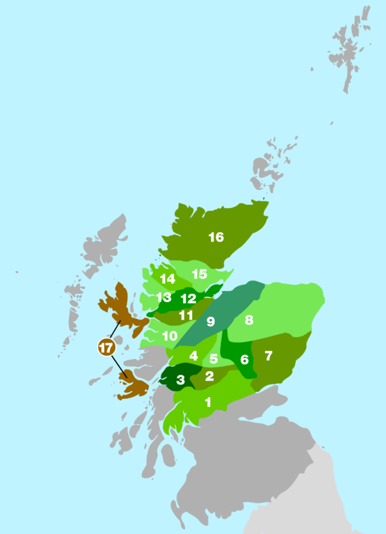
English: Rough outline of the areas used in Munro's 1891 tables to divide up the mountain ranges of Scotland. Map based on information in the 2006 edition of The Munros - SMC Hillwalkers' Guide ISBN 0907521940 |
| Foinse | Obair féin |
| Údar | Cnbrb |
Ceadúnú
| I, the copyright holder of this work, release this work into the public domain. This applies worldwide. In some countries this may not be legally possible; if so: I grant anyone the right to use this work for any purpose, without any conditions, unless such conditions are required by law. |
Stair chomhaid
Cliceáil ar dáta/am chun an comhad a radharc mar a bhí sé ag an am sin.
| Dáta/Am | Mionsamhail | Toisí | Úsáideoir | Nóta tráchta | |
|---|---|---|---|---|---|
| faoi láthair | 21:54, 26 Iúil 2008 | | 2,109 × 2,916 (341 KB) | Cnbrb | {{Information |Description= English: English: Rough outline of the areas used in Munro's 1891 tables to divide up the mountain ranges of Scotland. Map based on information in the 2006 edition of The Munros - SMC Hillwalkers' Guide ISBN 0907521940 |Source |
| 20:00, 27 Meitheamh 2008 |  | 600 × 828 (75 KB) | Cnbrb | {{Information |Description={{en|1=English: Rough outline of the areas used in Munro's 1891 tables to divide up the mountain ranges of Scotland. Map based on information in the 2006 edition of '''The Munros - SMC Hillwalkers' Guide''' ISBN 0907521940}} |So |
Úsáid comhaid
Tá nasc chuig an gcomhad seo ar na leathanaigh seo a leanas:
Global file usage
The following other wikis use this file:
- Úsáid ar bg.wikipedia.org
- Úsáid ar cy.wikipedia.org
- Úsáid ar de.wikipedia.org
- Úsáid ar en.wikipedia.org
- Úsáid ar es.wikipedia.org
- Úsáid ar eu.wikipedia.org
- Úsáid ar it.wikipedia.org
- Úsáid ar nl.wikipedia.org
- Úsáid ar nn.wikipedia.org
- Úsáid ar no.wikipedia.org
- Úsáid ar www.wikidata.org