
Íomhá:Overlooking central Broughty Ferry - geograph.org.uk - 9682.jpg
Níl aon taifeach is mó ar fáil.
Overlooking_central_Broughty_Ferry_-_geograph.org.uk_-_9682.jpg (640 × 480 picteilín, méid comhaid: 120 KB, cineál MIME: image/jpeg)
| Seo comhad as An Cómhaoin Viciméid. Tá an tuairisc as an leathanach tuairisc Cómhaoin a leanas thíos.
|
Achoimriú
| Tuairisc |
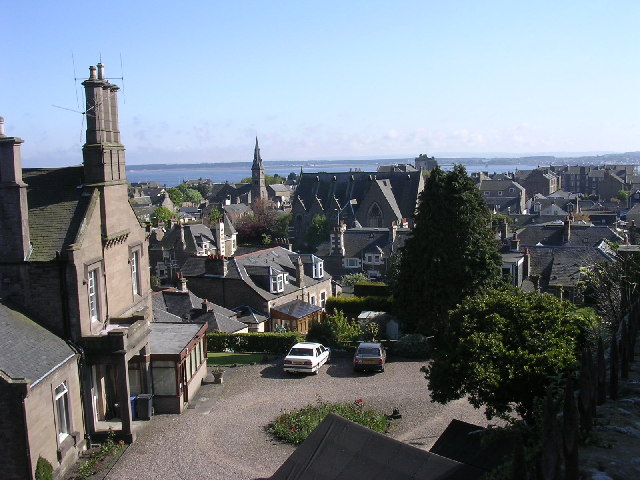
English: Overlooking central Broughty Ferry. This view over the rooftops of central Broughty Ferry extends to the Firth of Tay and the wooded area of Tentsmuir Point on the Fife side of the estuary. The church spire which breaks the line of the rooftops is East Church, in NO4630 |
| Dáta | |
| Foinse | From geograph.org.uk |
| Údar | Val Vannet |
| Creidiúint (required by the license) | Val Vannet / Overlooking central Broughty Ferry / |
| Object location | | View this and other nearby images on: OpenStreetMap |
|---|
_&language=ga)
Ceadúnú

|
This image was taken from the Geograph project collection. See this photograph's page on the Geograph website for the photographer's contact details. The copyright on this image is owned by Val Vannet and is licensed for reuse under the Creative Commons Attribution-ShareAlike 2.0 license.
|
This file is licensed under the Creative Commons Attribution-Share Alike 2.0 Generic license.
Creidiúint: Val Vannet
- Is féidir:
- an saothar seo a roinnt – an saothar seo a chóipeáil, a dháil amach, agus a tharchur
- an saothar seo a athmheascadh – an saothar seo a oiriúnú
- Ach amháin má leantar na coinníollacha seo a leanas:
- sannadh – Ní mor creidiúint a thabhairt leis an saothar, faoi mar a shonraigh an údar nó tabharthóir an ceadúnais (ach ná húsáid modh a thugann le fios go thacaíonn sé/sí tú féin nó an úsáid a bhaineann tú as an saothar).
- comhroinn araon – Má athraíonn tú nó síneann tú amach an saothar seo, ní féidir é a dháileadh ach amhaín faoin gceadúnas céanna nó ceann cosúil leis an gceann seo.
Stair chomhaid
Cliceáil ar dáta/am chun an comhad a radharc mar a bhí sé ag an am sin.
| Dáta/Am | Mionsamhail | Toisí | Úsáideoir | Nóta tráchta | |
|---|---|---|---|---|---|
| faoi láthair | 02:56, 30 Eanáir 2010 | | 640 × 480 (120 KB) | GeographBot | == {{int:filedesc}} == {{Information |description={{en|1=Overlooking central Broughty Ferry. This view over the rooftops of central Broughty Ferry extends to the Firth of Tay and the wooded area of Tentsmuir Point on the Fife side of the estuary. The chu |
Úsáid comhaid
Níl nasc ó aon leathanach eile don íomhá seo.
Global file usage
The following other wikis use this file:
- Úsáid ar es.wikipedia.org