
Íomhá:Nova Scotia-map.png
Níl aon taifeach is mó ar fáil.
Nova_Scotia-map.png (280 × 230 picteilín, méid comhaid: 14 KB, cineál MIME: image/png)
| Seo comhad as An Cómhaoin Viciméid. Tá an tuairisc as an leathanach tuairisc Cómhaoin a leanas thíos.
|

|
File:Nova Scotia, Canada.svg is a vector version of this file. It should be used in place of this PNG file when not inferior.
File:Nova Scotia-map.png → File:Nova Scotia, Canada.svg
For more information, see Help:SVG. |
 |
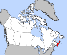
Map of Nova Scotia
Projection: Lambert azimuthal equal-area
Geospatial data from: The Atlas of Canada, The National Atlas of the United States and U.S. Geological Survey
Cartographer: John Fowler
| I, the copyright holder of this work, release this work into the public domain. This applies worldwide. In some countries this may not be legally possible; if so: I grant anyone the right to use this work for any purpose, without any conditions, unless such conditions are required by law. |
Stair chomhaid
Cliceáil ar dáta/am chun an comhad a radharc mar a bhí sé ag an am sin.
| Dáta/Am | Mionsamhail | Toisí | Úsáideoir | Nóta tráchta | |
|---|---|---|---|---|---|
| faoi láthair | 12:16, 24 Márta 2005 | | 280 × 230 (14 KB) | Voyager | Map of Nova Scotia Projection: Lambert azimuthal equal-area Geospatial data from: [http://atlas.gc.ca/ The Atlas of Canada], [http://www.nationalatlas.gov/ The National Atlas of the United States] and [http://www.usgs.gov U.S. Geological Survey] Cartog |
Úsáid comhaid
Níl nasc ó aon leathanach eile don íomhá seo.
Global file usage
The following other wikis use this file:
- Úsáid ar azb.wikipedia.org
- Úsáid ar bat-smg.wikipedia.org
- Úsáid ar br.wikipedia.org
- Úsáid ar en.wikipedia.org
- Úsáid ar en.wikinews.org
- Úsáid ar en.wiktionary.org
- Úsáid ar eo.wikipedia.org
- Úsáid ar frr.wikipedia.org
- Úsáid ar gd.wikipedia.org
- Úsáid ar hu.wiktionary.org
- Úsáid ar io.wikipedia.org
- Úsáid ar is.wikipedia.org
- Úsáid ar ja.wikipedia.org
- Úsáid ar kw.wikipedia.org
- Úsáid ar lij.wikipedia.org
- Úsáid ar mk.wikipedia.org
- Úsáid ar nn.wikipedia.org
- Úsáid ar pam.wikipedia.org
- Úsáid ar pms.wikipedia.org
- Úsáid ar ta.wikipedia.org
- Úsáid ar vo.wikipedia.org
- Úsáid ar xmf.wikipedia.org
- Úsáid ar zh-min-nan.wikipedia.org