
Íomhá:Lage des Landkreises Mansfelder Land in Deutschland.png
Níl aon taifeach is mó ar fáil.
Lage_des_Landkreises_Mansfelder_Land_in_Deutschland.png (176 × 234 picteilín, méid comhaid: 5 KB, cineál MIME: image/png)
| Seo comhad as An Cómhaoin Viciméid. Tá an tuairisc as an leathanach tuairisc Cómhaoin a leanas thíos.
|
Achoimriú
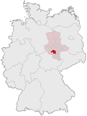
Karte erstellt auf der Grundlage der opengeodb.de-Umrisse.
Moved from de.wikipedia.org, first uploaded by de:Benutzer:Geograv.
Ceadúnú
This image was generated with OpenGeoDB. The information there is placed in the public domain, images generated from OpenGeoDB are derivative works without passing the threshold of creativity, they are therefore also public domain.
| This work is ineligible for copyright and therefore in the public domain because it consists entirely of information that is common property and contains no original authorship. |
Stair chomhaid
Cliceáil ar dáta/am chun an comhad a radharc mar a bhí sé ag an am sin.
| Dáta/Am | Mionsamhail | Toisí | Úsáideoir | Nóta tráchta | |
|---|---|---|---|---|---|
| faoi láthair | 12:34, 1 Márta 2006 | | 176 × 234 (5 KB) | Tsca.bot | Karte erstellt auf der Grundlage der opengeodb.de-Umrisse - GNU-FDL Moved from http://de.wikipedia.org {{GFDL}} Category:Maps of Germany |
Úsáid comhaid
Níl nasc ó aon leathanach eile don íomhá seo.
Global file usage
The following other wikis use this file:
- Úsáid ar ceb.wikipedia.org
- Úsáid ar de.wikipedia.org
- Úsáid ar es.wikipedia.org
- Úsáid ar fr.wikipedia.org
- Úsáid ar id.wikipedia.org
- Úsáid ar it.wikipedia.org
- Úsáid ar ka.wikipedia.org
- Úsáid ar kk.wikipedia.org
- Úsáid ar nl.wikipedia.org
- Úsáid ar pl.wikipedia.org
- Úsáid ar pt.wikipedia.org
- Úsáid ar www.wikidata.org