Íomhá:Karnataka locator map.svg
Page contents not supported in other languages.
Ón Vicipéid, an chiclipéid shaor.

Taispeáin leagan ardtaifigh den íomhá(Comhad SVG, ainmniúil 1,630 × 2,356 picteilíni, méid comhaid: 235 KB)

Seo comhad as An Cómhaoin Viciméid. Tá an tuairisc as an leathanach tuairisc Cómhaoin a leanas thíos.
Is stór comhaid meáin Saor é an Cómhaoin Viciméid. Is féidir leat cabhrú.
Teideal
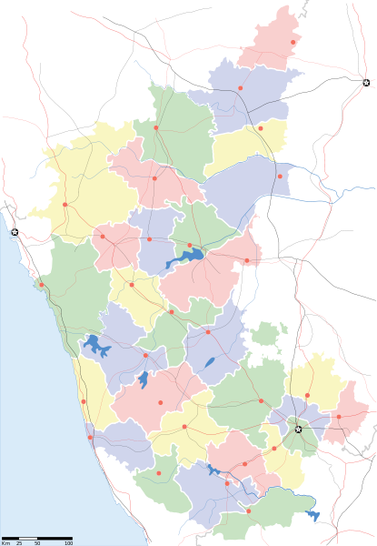
Karnataka locator Map
Cur síos
Map of w:Karnataka with road and rail lines
Dáta
Foinse

Obair féin
International Borders: University of Texas map library - India Political map 2001
Disputed Borders: University of Texas map library - China-India Borders - Eastern Sector 1988 & Western Sector 1988 - Kashmir Region 2004 - Kashmir Maps.
State and District boundaries: Census of India - 2001 Census State Maps - Survey of India Maps.
Other sources: US Army Map Service, Survey of India Map Explorer, Columbia University

Map specific sources: Karnataka Map, South Western Railway Map.
Cruthaitheoir

যে নষ্ট

This Image was created by User:PlaneMad.
  • If you are using the image under the creative commons share alike license please credit the photo CC-by-sa PlaneMad/Wikimedia and include a link to this page. No explicit permission is needed from me, but id appreciate an email if my work has been of help to you.
  • If you dont want to release your work under a creative commons license, please mail me at arun.planemad@gmail.com or catch me at my Website to negotiate a custom license as per your needs.
Ceadúnas
(Athúsáid a bhaint as an gcomhad seo)
Is mise sealbhóir cóipchirt an shaothair seo agus foilsím é faoin gceadúnas seo a leanas:
w:ga:Creative Commons
sannadh comhroinn araon
This file is licensed under the Creative Commons Attribution-Share Alike 3.0 Unported license.
Is féidir:
  • an saothar seo a roinnt – an saothar seo a chóipeáil, a dháil amach, agus a tharchur
  • an saothar seo a athmheascadh – an saothar seo a oiriúnú
Ach amháin má leantar na coinníollacha seo a leanas:
  • sannadh – Ní mor creidiúint a thabhairt leis an saothar, faoi mar a shonraigh an údar nó tabharthóir an ceadúnais (ach ná húsáid modh a thugann le fios go thacaíonn sé/sí tú féin nó an úsáid a bhaineann tú as an saothar).
  • comhroinn araon – Má athraíonn tú nó síneann tú amach an saothar seo, ní féidir é a dháileadh ach amhaín faoin gceadúnas céanna nó ceann cosúil leis an gceann seo.

The frontiers depicted on the Indian maps in Wikipedia are from a neutral point of view and may differ from official government maps of India, Pakistan and China. Please consult local laws governing publication of maps before usage.
 Geotemporal data
Dáta a léiríodh second half of 20 century agus 21 century
Georeferencing Georeference the map in Wikimaps Warper If inappropriate please set warp_status = skip to hide.
 Archival data
Notes Part of WikiProject India Maps


derivative works

Derivative works of this file:  India Karnataka location map.svg

Captions

Add a one-line explanation of what this file represents

Items portrayed in this file

taispeánann sé/sí

Stair chomhaid

Cliceáil ar dáta/am chun an comhad a radharc mar a bhí sé ag an am sin.

Dáta/AmMionsamhailToisíÚsáideoirNóta tráchta
faoi láthair10:48, 20 Samhain 2010Mionsamhail do leagan ó 10:48, 20 Samhain 20101,630 × 2,356 (235 KB)NayvikCreated 3 new districts Chikballapur district, Ramanagara district and Yadgir district
10:07, 8 Bealtaine 2007Mionsamhail do leagan ó 10:07, 8 Bealtaine 20071,630 × 2,356 (226 KB)Planemadchg color of chamarajanagar
13:55, 6 Bealtaine 2007Mionsamhail do leagan ó 13:55, 6 Bealtaine 20071,630 × 2,356 (226 KB)Planemad{{WikiProject_India_Maps |Title=Karnataka locator Map |Description=Map of w:Karnataka with road and rail lines |Source= [http://aquarium.lipetsk.ru/discovery/India2004/karnataka-map.jpg Karnataka Map], [http://www.indianrailways.gov.in/maps/st-wt-rly.

Tá nasc chuig an gcomhad seo ar na leathanaigh seo a leanas:

Global file usage

The following other wikis use this file:

View more global usage of this file.

Meiteasonraí