
Íomhá:Ireland900.png
Size of this preview: 469 × 599 picteilín. Other resolutions: 188 × 240 picteilín | 376 × 480 picteilín | 601 × 768 picteilín | 802 × 1,024 picteilín | 2,060 × 2,630 picteilín.
Taispeáin leagan ardtaifigh den íomhá (2,060 × 2,630 picteilín, méid comhaid: 512 KB, cineál MIME: image/png)
| Seo comhad as An Cómhaoin Viciméid. Tá an tuairisc as an leathanach tuairisc Cómhaoin a leanas thíos.
|
Achoimriú
| Tuairisc |
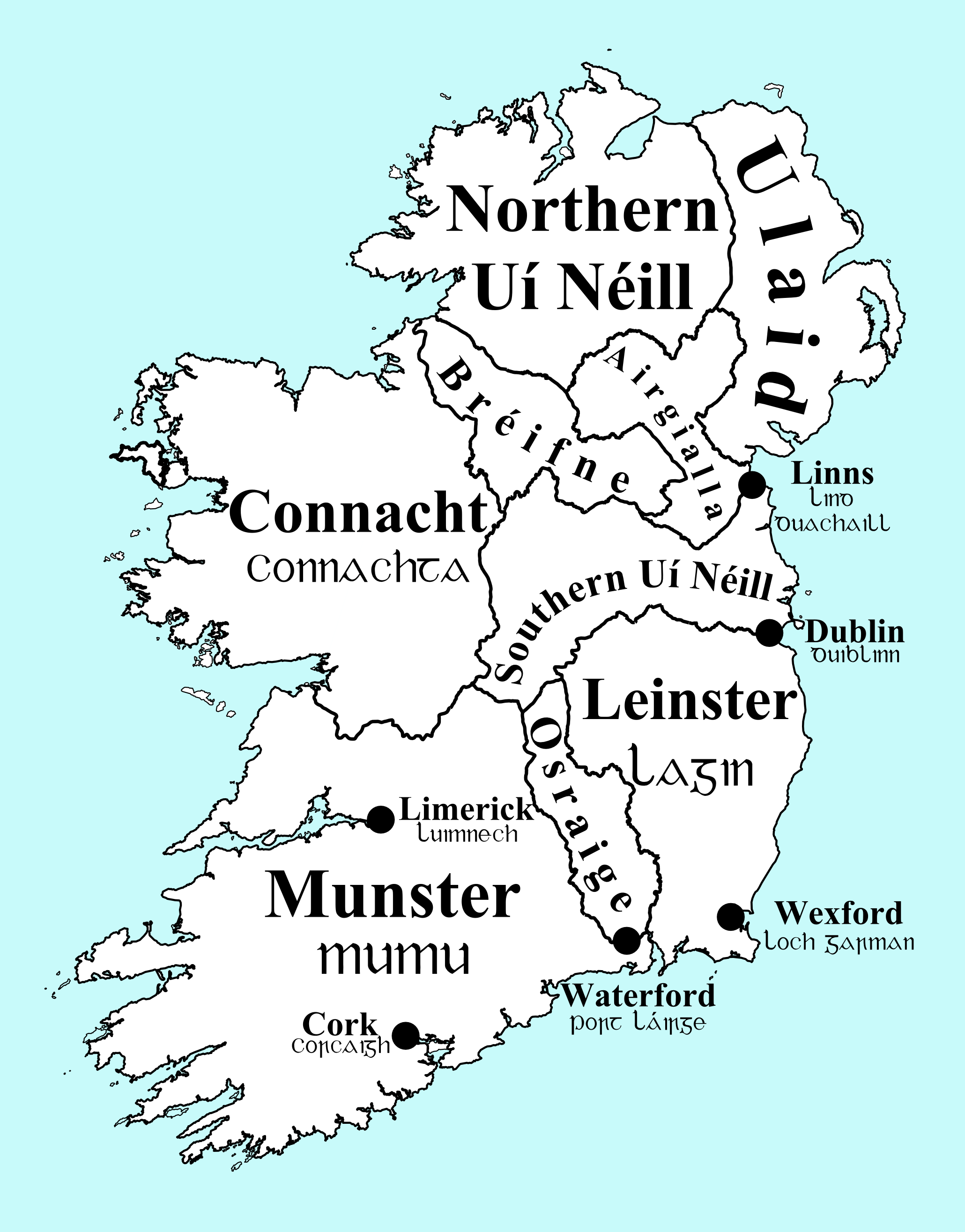
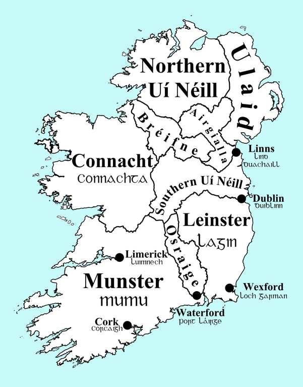
English: Map of Ireland, circa 900, with overkingdoms and principal (Viking) towns indicated.
Português: Mapa de Irlanda, perto do ano 900, ilustrando os reinos e principais cidades da época. |
| Dáta | |
| Foinse | Obair féin |
| Údar | Erakis |
| Leaganacha eile | Ireland900.svg |
Ceadúnú
| I, the copyright holder of this work, release this work into the public domain. This applies worldwide. In some countries this may not be legally possible; if so: I grant anyone the right to use this work for any purpose, without any conditions, unless such conditions are required by law. |
Stair chomhaid
Cliceáil ar dáta/am chun an comhad a radharc mar a bhí sé ag an am sin.
| Dáta/Am | Mionsamhail | Toisí | Úsáideoir | Nóta tráchta | |
|---|---|---|---|---|---|
| faoi láthair | 22:44, 22 Nollaig 2013 | | 2,060 × 2,630 (512 KB) | Ras67 | cropped |
| 13:05, 31 Iúil 2010 |  | 2,109 × 2,749 (742 KB) | Erakis~commonswiki | {{Information |Description={{en|1=png map of Ireland circa 900, with overkingdoms and principal towns indicated}} |Source={{own}} |Author=Erakis |Date=2010-07-31 |Permission= |other_versions=Ireland900.svg }} [[Category:Maps of Irelan |
Úsáid comhaid
Tá nasc chuig an gcomhad seo ar 4 an leathanach seo a leanas:
Global file usage
The following other wikis use this file:
- Úsáid ar ar.wikipedia.org
- Úsáid ar bn.wikipedia.org
- Úsáid ar br.wikipedia.org
- Úsáid ar ca.wikipedia.org
- Úsáid ar cs.wikipedia.org
- Úsáid ar da.wikipedia.org
- Úsáid ar de.wikipedia.org
- Úsáid ar el.wikipedia.org
- Úsáid ar en.wikipedia.org
- Anarcho-capitalism
- County Laois
- Provinces of Ireland
- Monarchy of Ireland
- History of Limerick
- List of Irish kingdoms
- Ulaid
- Fíatach Finn
- Ketill Flatnose
- Irish clans
- Southern Uí Néill
- Tigernán Ua Ruairc
- McGee (surname)
- Doolan
- Amlaíb Conung
- McGowan
- Bishop of Kilmore
- Auisle
- Devaney
- Kelly (surname)
- Ímar
- User:Mrchris/Timeline of County Kilkenny
- Early Scandinavian Dublin
- Downey (surname)
- Northern Uí Néill
- Úsáid ar es.wikipedia.org
- Úsáid ar eu.wikipedia.org
- Úsáid ar fa.wikipedia.org
- Úsáid ar fr.wikipedia.org
- Úsáid ar hi.wikipedia.org
- Úsáid ar it.wikipedia.org
- Úsáid ar kab.wikipedia.org
View more global usage of this file.