
Íomhá:Greater Geelong.png
Size of this preview: 408 × 599 picteilín. Other resolutions: 163 × 240 picteilín | 327 × 480 picteilín | 697 × 1,024 picteilín.
Taispeáin leagan ardtaifigh den íomhá (697 × 1,024 picteilín, méid comhaid: 1.47 MB, cineál MIME: image/png)
| Seo comhad as An Cómhaoin Viciméid. Tá an tuairisc as an leathanach tuairisc Cómhaoin a leanas thíos.
|
| Tuairisc |
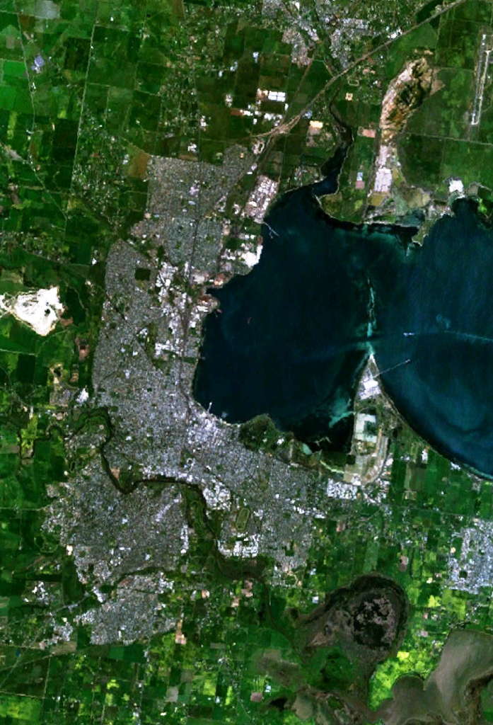
English: w:Geelong, Victoria and suburbs, including Lara in the north, Grovedale in the south-west and Moolap in the south-east. The western end of Corio Bay, including Point Henry, is visible. |
| Foinse | Obair féin |
| Údar | user:Stephen Bain |
| This image is in the public domain because it is a screenshot from NASA’s globe software World Wind using a public domain layer, such as Blue Marble, MODIS, Landsat, SRTM, USGS or GLOBE.
|
 |
Stair chomhaid
Cliceáil ar dáta/am chun an comhad a radharc mar a bhí sé ag an am sin.
| Dáta/Am | Mionsamhail | Toisí | Úsáideoir | Nóta tráchta | |
|---|---|---|---|---|---|
| faoi láthair | 04:30, 30 Nollaig 2005 | | 697 × 1,024 (1.47 MB) | Stephen Bain | w:Geelong, Victoria and suburbs, including Lara in the north, Grovedale in the south-west and Moolap in the south-east. The western end of Corio Bay, including Point Henry, is visible. {{PD-WorldWind}} |
Úsáid comhaid
Tá nasc chuig an gcomhad seo ar na leathanaigh seo a leanas:
Global file usage
The following other wikis use this file:
- Úsáid ar de.wikipedia.org
- Úsáid ar en.wikipedia.org
- Úsáid ar fr.wikipedia.org
- Úsáid ar he.wikipedia.org
- Úsáid ar ja.wikipedia.org
- Úsáid ar sv.wikipedia.org