
Íomhá:EU Globe No Borders.svg

Size of this PNG preview of this SVG file: 600 × 600 picteilín. Other resolutions: 240 × 240 picteilín | 480 × 480 picteilín | 768 × 768 picteilín | 1,024 × 1,024 picteilín | 2,048 × 2,048 picteilín | 792 × 792 picteilín.
Taispeáin leagan ardtaifigh den íomhá (Comhad SVG, ainmniúil 792 × 792 picteilíni, méid comhaid: 5.4 MB)
| Seo comhad as An Cómhaoin Viciméid. Tá an tuairisc as an leathanach tuairisc Cómhaoin a leanas thíos.
|
| Tuairisc |
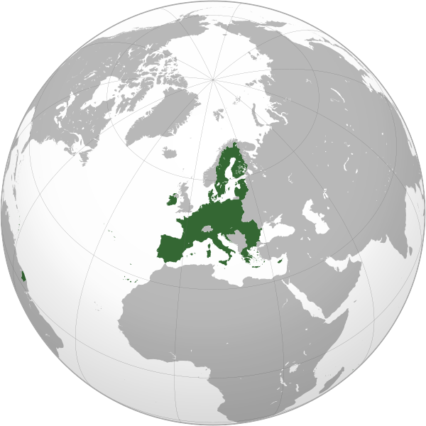
English: The European Union in an orthographic projection with no borders between member states
Italiano: L'Unione europea in una proiezione ortografica senza confini tra gli stati membri
Aontas Eorpach |
||
| Dáta | |||
| Foinse | File:Global European Union.svg | ||
| Údar |
|
||
| Leaganacha eile |
|
||
| SVG genesis |
|


.svg)
Is mise sealbhóir cóipchirt an shaothair seo agus foilsím é faoin gceadúnas seo a leanas:
This file is licensed under the Creative Commons Attribution 3.0 Unported license.
- Is féidir:
- an saothar seo a roinnt – an saothar seo a chóipeáil, a dháil amach, agus a tharchur
- an saothar seo a athmheascadh – an saothar seo a oiriúnú
- Ach amháin má leantar na coinníollacha seo a leanas:
- sannadh – Ní mor creidiúint a thabhairt leis an saothar, faoi mar a shonraigh an údar nó tabharthóir an ceadúnais (ach ná húsáid modh a thugann le fios go thacaíonn sé/sí tú féin nó an úsáid a bhaineann tú as an saothar).
Original upload log
This image is a derivative work of the following images:
- File:Global_European_Union.svg licensed with Cc-by-3.0
- 2009-06-21T16:53:41Z Ssolbergj 541x541 (499935 Bytes) Revert. Please upload under a new file name.
- 2009-06-21T16:49:11Z WikiLaurent 237x196 (1314189 Bytes) Trimmed down map (left enough space for Turkey :), put back country borders, and used EU flag color.
- 2008-10-23T22:17:10Z Ssolbergj 541x541 (499935 Bytes) Added Malta.
- 2008-10-23T22:15:04Z Ssolbergj 541x541 (499936 Bytes) Added Malta.
- 2008-10-19T04:05:53Z Ssolbergj 541x541 (499841 Bytes) {{Information |Description= |Source= |Date= |Author= |Permission= |other_versions= }}
- 2008-07-19T19:26:49Z Ssolbergj 541x541 (499524 Bytes) {{Information |Description= |Source= |Date= |Author= |Permission= |other_versions= }}
- 2008-07-19T19:19:17Z Ssolbergj 541x541 (499516 Bytes) {{Information |Description= |Source= |Date= |Author= |Permission= |other_versions= }}
- 2008-06-12T02:41:09Z Ssolbergj 541x541 (1227043 Bytes) {{Information |Description= |Source= |Date= |Author= |Permission= |other_versions= }}
- 2008-06-12T02:36:55Z Ssolbergj 541x541 (1227438 Bytes) {{Information |Description= |Source= |Date= |Author= |Permission= |other_versions= }}
- 2007-05-22T19:13:55Z Ssolbergj 429x425 (697924 Bytes) == Summary == Partly from [http://en.wikipedia.org/wiki/Image:Global_warming_ubx.svg]. == Licensing == {{self|GFDL-no-disclaimers|cc-by-2.5}}
Uploaded with derivativeFX
Stair chomhaid
Cliceáil ar dáta/am chun an comhad a radharc mar a bhí sé ag an am sin.
| Dáta/Am | Mionsamhail | Toisí | Úsáideoir | Nóta tráchta | |
|---|---|---|---|---|---|
| faoi láthair | 09:23, 2 Feabhra 2020 | | 792 × 792 (5.4 MB) | Rob984 | Fixed Flevoland in the Netherlands and general code cleanup (removing redundant groups etc.) |
| 00:28, 2 Feabhra 2020 |  | 792 × 792 (5.43 MB) | Rob984 | Reverted and redone UK's withdrawal to restore gradient and better map base. | |
| 16:39, 1 Feabhra 2020 |  | 541 × 541 (153 KB) | Hogweard | Update | |
| 18:30, 22 Meitheamh 2018 |  | 792 × 792 (5.24 MB) | Rob984 | Updated version | |
| 21:14, 30 Meitheamh 2013 |  | 541 × 541 (149 KB) | Atoine85 | Reverted to version as of 17:41, 30 June 2013 | |
| 17:41, 30 Meitheamh 2013 |  | 541 × 541 (143 KB) | Spesh531 | Reverted to version as of 16:52, 30 June 2013 croatia is not EU yet, just making file | |
| 17:41, 30 Meitheamh 2013 |  | 541 × 541 (149 KB) | Spesh531 | combined Croatia with European Union | |
| 16:52, 30 Meitheamh 2013 |  | 541 × 541 (143 KB) | Delusion23 | Reverted to version as of 02:50, 7 March 2012. They aren't in the EU yet. | |
| 10:48, 30 Meitheamh 2013 |  | 541 × 541 (154 KB) | Travelpleb | Minor fix | |
| 10:35, 30 Meitheamh 2013 |  | 541 × 541 (154 KB) | Travelpleb | Croatia --> EU |
Úsáid comhaid
Níl nasc ó aon leathanach eile don íomhá seo.
Global file usage
The following other wikis use this file:
- Úsáid ar av.wikipedia.org
- Úsáid ar azb.wikipedia.org
- Úsáid ar az.wikipedia.org
- Úsáid ar bh.wikipedia.org
- Úsáid ar bn.wikipedia.org
- Úsáid ar bn.wikivoyage.org
- Úsáid ar ce.wikipedia.org
- Úsáid ar ch.wikipedia.org
- Úsáid ar cs.wikipedia.org
- Úsáid ar da.wikipedia.org
- Úsáid ar dty.wikipedia.org
- Úsáid ar en.wikipedia.org
- Úsáid ar en.wikiversity.org
- Úsáid ar en.wikivoyage.org
- Úsáid ar eo.wikivoyage.org
- Úsáid ar es.wikivoyage.org
- Úsáid ar gu.wikipedia.org
- Úsáid ar hi.wikipedia.org
- Úsáid ar hu.wikipedia.org
- Úsáid ar id.wikipedia.org
- Úsáid ar ilo.wikipedia.org
View more global usage of this file.