
Íomhá:DDR2 ram mounted.jpg
Size of this preview: 800 × 534 picteilín. Other resolutions: 320 × 213 picteilín | 640 × 427 picteilín | 1,024 × 683 picteilín | 1,280 × 854 picteilín | 1,600 × 1,067 picteilín.
Taispeáin leagan ardtaifigh den íomhá (1,600 × 1,067 picteilín, méid comhaid: 614 KB, cineál MIME: image/jpeg)
| Seo comhad as An Cómhaoin Viciméid. Tá an tuairisc as an leathanach tuairisc Cómhaoin a leanas thíos.
|
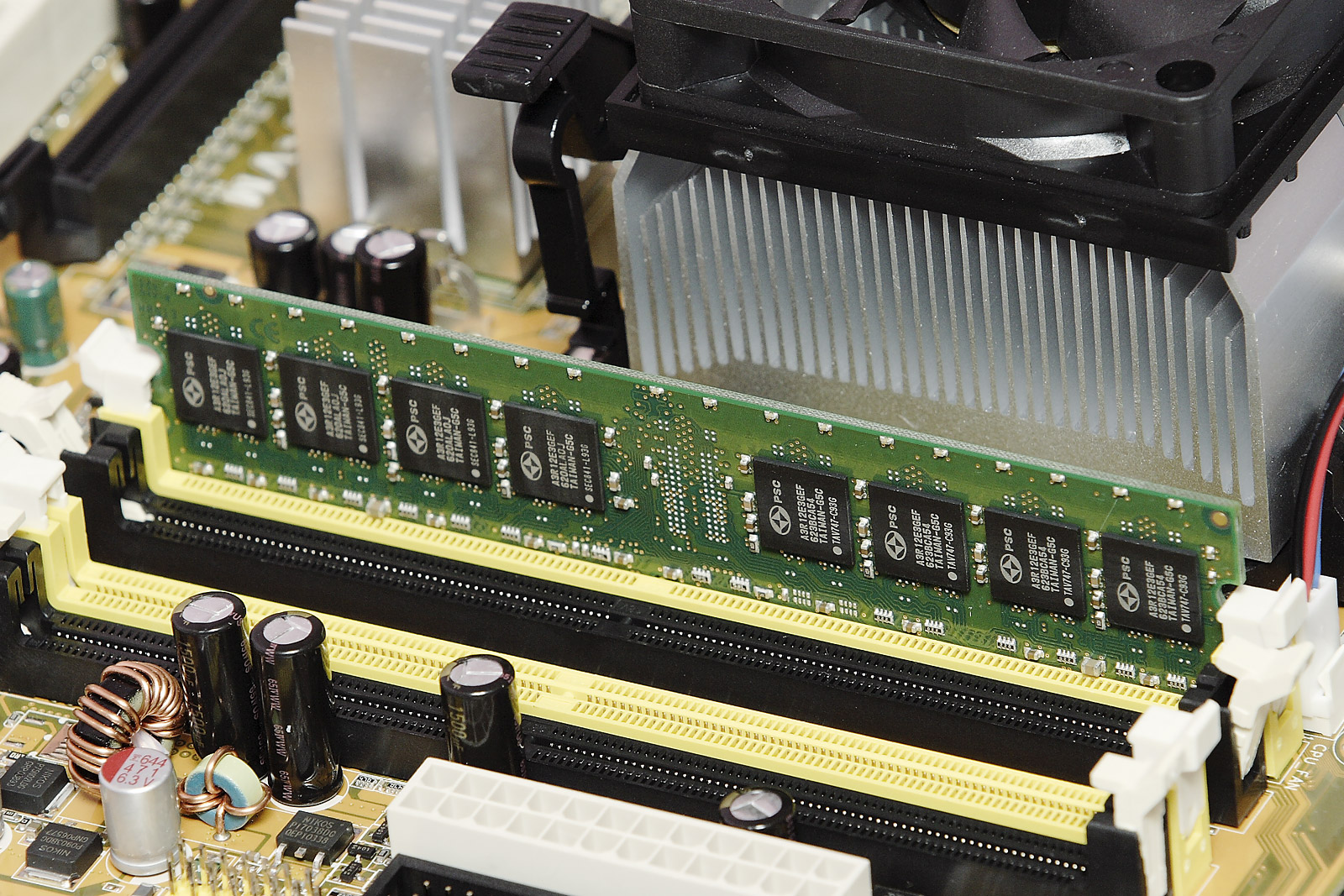
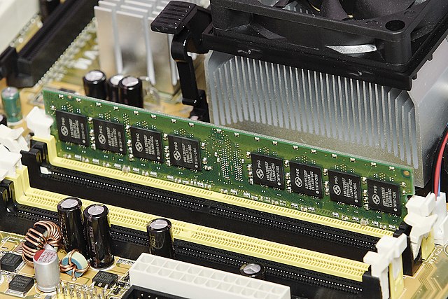
Powerchip Semiconductor Corporation DDR2 RAM in socket
|


| ||||||||


|
Permission is granted to copy, distribute and/or modify this document under the terms of the GNU Free Documentation License, Version 1.2 only as published by the Free Software Foundation; with no Invariant Sections, no Front-Cover Texts, and no Back-Cover Texts. A copy of the license is included in the section entitled GNU Free Documentation License. | 1.2 only |
This file is published under the following Creative Commons license:
Attribution NonCommercial Unported 3.0 |
| Camera location | | View this and other nearby images on: OpenStreetMap |
|---|
Stair chomhaid
Cliceáil ar dáta/am chun an comhad a radharc mar a bhí sé ag an am sin.
| Dáta/Am | Mionsamhail | Toisí | Úsáideoir | Nóta tráchta | |
|---|---|---|---|---|---|
| faoi láthair | 22:30, 25 Samhain 2006 | | 1,600 × 1,067 (614 KB) | Fir0002 | DDR2 Ram in socket {{Fir0002 85}} |
Úsáid comhaid
Tá nasc chuig an gcomhad seo ar na leathanaigh seo a leanas:
Global file usage
The following other wikis use this file:
- Úsáid ar ar.wikipedia.org
- Úsáid ar azb.wikipedia.org
- Úsáid ar bs.wikipedia.org
- Úsáid ar cs.wikipedia.org
- Úsáid ar da.wikipedia.org
- Úsáid ar en.wikipedia.org
- Úsáid ar en.wikibooks.org
- How To Assemble A Desktop PC/Assembly
- How To Assemble A Desktop PC/Printable version
- The Computer Revolution/Hardware/Storage
- A-level Computing 2009/AQA/Computer Components, The Stored Program Concept and the Internet/Machine Level Architecture/Internal and external hardware components of a computer
- A-level Computing 2009/AQA/Print version/Unit 2
- A-level Computing/AQA/Computer Components, The Stored Program Concept and the Internet/Machine Level Architecture/Internal and external hardware components of a computer
- A-level Computing/AQA/Print version/Unit 2
- A-level Computing/AQA/Paper 2/Fundamentals of computer organisation and architecture/Internal hardware components of a computer
- GCSE Computer Science/Memory
- Úsáid ar en.wikiversity.org
- Úsáid ar eo.wikipedia.org
- Úsáid ar es.wikiversity.org
- Úsáid ar fa.wikipedia.org
- Úsáid ar fy.wikipedia.org
- Úsáid ar gl.wikipedia.org
- Úsáid ar hi.wikipedia.org
- Úsáid ar hy.wikipedia.org
- Úsáid ar ka.wikipedia.org
- Úsáid ar kk.wikipedia.org
- Úsáid ar ko.wikipedia.org
- Úsáid ar ms.wikipedia.org
- Úsáid ar my.wikipedia.org
- Úsáid ar nl.wikipedia.org
- Úsáid ar nn.wikipedia.org
- Úsáid ar no.wikipedia.org
- Úsáid ar pa.wikipedia.org
- Úsáid ar pa.wikibooks.org
- Úsáid ar pl.wikibooks.org
- Úsáid ar pt.wikipedia.org
- Úsáid ar pt.wikibooks.org
- Úsáid ar ru.wikipedia.org
- Úsáid ar sq.wikipedia.org
- Úsáid ar te.wikipedia.org
View more global usage of this file.