
Íomhá:Aga Buryatia.png

Size of this preview: 800 × 517 picteilín. Other resolutions: 320 × 207 picteilín | 640 × 414 picteilín | 950 × 614 picteilín.
Taispeáin leagan ardtaifigh den íomhá (950 × 614 picteilín, méid comhaid: 31 KB, cineál MIME: image/png)
| Seo comhad as An Cómhaoin Viciméid. Tá an tuairisc as an leathanach tuairisc Cómhaoin a leanas thíos.
|
Achoimriú
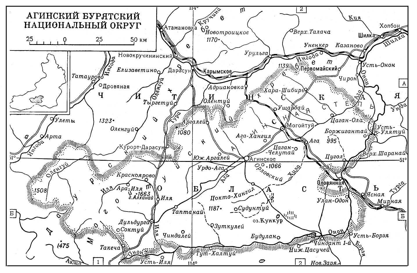
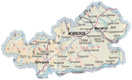
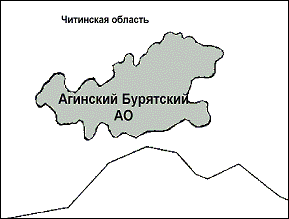
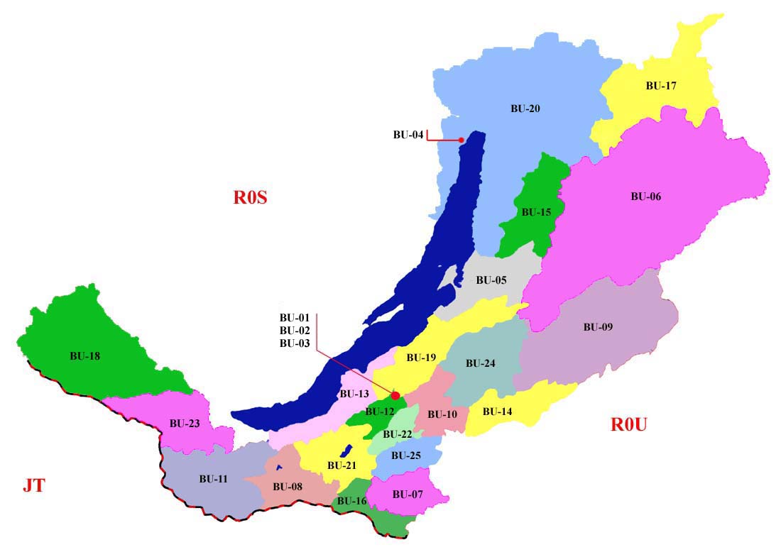
| Tuairisc | Map of Aga Buryatia (Agin-Buryat Autonomous Okrug) in Russia, until 2008. |
| Dáta | |
| Foinse | Obair féin |
| Údar | PANONIAN |
Ceadúnú
Is mise sealbhóir cóipchirt an shaothair seo agus foilsím é faoin gceadúnas seo a leanas:
| This file is made available under the Creative Commons CC0 1.0 Universal Public Domain Dedication. | |
| The person who associated a work with this deed has dedicated the work to the public domain by waiving all of their rights to the work worldwide under copyright law, including all related and neighboring rights, to the extent allowed by law. You can copy, modify, distribute and perform the work, even for commercial purposes, all without asking permission.
|
References
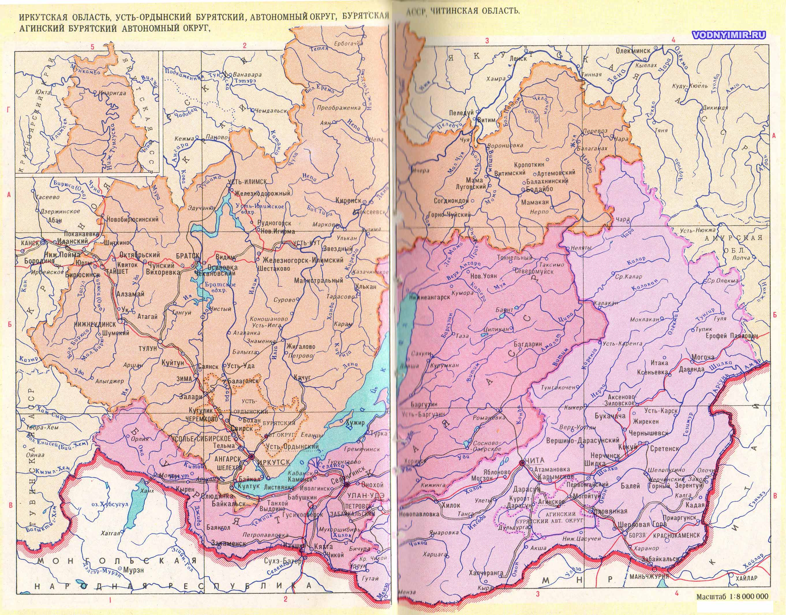
Maps from external links:
- http://rdaward.org/map/8v.jpg
- http://bse.sci-lib.com/a_pictures/01/04/260338584.jpg
- http://modvark.com/public/image/plan_altargana(1).jpg
- http://www.aginsk-pravda.ru/karta_abo.gif
- http://dic.academic.ru/pictures/enc_geo/Aginskiy_Buryatskiy_okrug.jpg
- https://www.usrbc.org/pics/Image/Russian%20Regions/Agin-Buryat/map_aginski.gif
- http://www.centerru.com/regions/images/image275_r.gif
- http://www.wdcb.ru/mining/obzor/Doc_1998/Maps/6-11j.gif
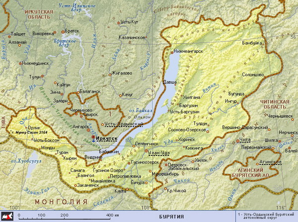
- http://www.vodnyimir.ru/images/map/Irkutskaya_obl.jpg
- http://www.irucz.ru/maps/114007012000.jpg
- http://asiadata.ru/images/598.gif archive copy at the Wayback Machine
- http://atlas.socpol.ru/maps/Chita_map.gif
- http://freemedline.ru/userfiles/map_burat.gif[dead link]
- http://planetolog.ru/maps/russia-oblast/Buryatia.jpg
- http://loi.sscc.ru/bdm/nso/attr/sfo/img/buryatia.gif archive copy at the Wayback Machine
- http://vsemirniysledopyt.ru/i/58/164158/i_001.png
- http://rdaward.org/map/0o.jpg
- http://files.vector-images.com/clipart/buryatia_map.gif archive copy at the Wayback Machine
- http://www.stalvik.com/images/Kartor/karta_burjatien.jpg
.jpg)
Stair chomhaid
Cliceáil ar dáta/am chun an comhad a radharc mar a bhí sé ag an am sin.
| Dáta/Am | Mionsamhail | Toisí | Úsáideoir | Nóta tráchta | |
|---|---|---|---|---|---|
| faoi láthair | 09:44, 10 Lúnasa 2012 | | 950 × 614 (31 KB) | PANONIAN | {{Information |Description=Map of Aga Buryatia (Agin-Buryat Autonomous Okrug) in Russia, until 2008. |Source={{own}} |Date=2012 |Author= PANONIAN |Permission= |other_versions= }} |
Úsáid comhaid
Tá nasc chuig an gcomhad seo ar na leathanaigh seo a leanas:
Global file usage
The following other wikis use this file:
- Úsáid ar az.wikipedia.org
- Úsáid ar bg.wikipedia.org
- Úsáid ar bxr.wikipedia.org
- Úsáid ar ca.wikipedia.org
- Úsáid ar cs.wikipedia.org
- Úsáid ar de.wikipedia.org
- Úsáid ar en.wikipedia.org
- Úsáid ar eo.wikipedia.org
- Úsáid ar es.wikipedia.org
- Úsáid ar et.wikipedia.org
- Úsáid ar fi.wikipedia.org
- Úsáid ar fr.wikipedia.org
- Úsáid ar he.wikipedia.org
- Úsáid ar hr.wikipedia.org
- Úsáid ar id.wikipedia.org
- Úsáid ar it.wikipedia.org
- Úsáid ar ko.wikipedia.org
- Úsáid ar lt.wikipedia.org
- Úsáid ar lv.wikipedia.org
- Úsáid ar ms.wikipedia.org
- Úsáid ar nl.wikipedia.org
- Úsáid ar nn.wikipedia.org
- Úsáid ar no.wikipedia.org
- Úsáid ar pl.wikipedia.org
- Úsáid ar pt.wikipedia.org
- Úsáid ar ro.wikipedia.org
- Úsáid ar ru.wikipedia.org
- Úsáid ar sh.wikipedia.org
- Úsáid ar sk.wikipedia.org
- Úsáid ar sr.wikipedia.org
- Úsáid ar sv.wikipedia.org
- Úsáid ar uk.wikipedia.org