
Íomhá:A "Brown flood" on the Mourne at Victoria Bridge. - geograph.org.uk - 434468.jpg
Níl aon taifeach is mó ar fáil.
A_"Brown_flood"_on_the_Mourne_at_Victoria_Bridge._-_geograph.org.uk_-_434468.jpg (640 × 426 picteilín, méid comhaid: 104 KB, cineál MIME: image/jpeg)
| Seo comhad as An Cómhaoin Viciméid. Tá an tuairisc as an leathanach tuairisc Cómhaoin a leanas thíos.
|
Achoimriú
| Tuairisc |
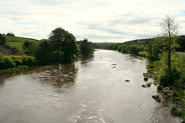
English: A "Brown flood" on the Mourne at Victoria Bridge. When in spate the locals refer to the condition as a "Brown flood" and it's then the worms are in demand being the most fruitful bait for trout and salmon when the water is thus.This particular beat was once the haunt of a former Northern Ireland prime minister and also myself and pals when noone was looking, especially Paddy McGuigan the water bailiff!!! |
| Dáta | |
| Foinse | From geograph.org.uk |
| Údar | Des Colhoun |
| Creidiúint (required by the license) | Des Colhoun / A "Brown flood" on the Mourne at Victoria Bridge. / |
| Camera location | | View this and other nearby images on: OpenStreetMap |
|---|
_heading:112.00&language=ga)
| Object location | | View this and other nearby images on: OpenStreetMap |
|---|
_heading:112.00&language=ga)
Ceadúnú

|
This image was taken from the Geograph project collection. See this photograph's page on the Geograph website for the photographer's contact details. The copyright on this image is owned by Des Colhoun and is licensed for reuse under the Creative Commons Attribution-ShareAlike 2.0 license.
|
This file is licensed under the Creative Commons Attribution-Share Alike 2.0 Generic license.
Creidiúint: Des Colhoun
- Is féidir:
- an saothar seo a roinnt – an saothar seo a chóipeáil, a dháil amach, agus a tharchur
- an saothar seo a athmheascadh – an saothar seo a oiriúnú
- Ach amháin má leantar na coinníollacha seo a leanas:
- sannadh – Ní mor creidiúint a thabhairt leis an saothar, faoi mar a shonraigh an údar nó tabharthóir an ceadúnais (ach ná húsáid modh a thugann le fios go thacaíonn sé/sí tú féin nó an úsáid a bhaineann tú as an saothar).
- comhroinn araon – Má athraíonn tú nó síneann tú amach an saothar seo, ní féidir é a dháileadh ach amhaín faoin gceadúnas céanna nó ceann cosúil leis an gceann seo.
Stair chomhaid
Cliceáil ar dáta/am chun an comhad a radharc mar a bhí sé ag an am sin.
| Dáta/Am | Mionsamhail | Toisí | Úsáideoir | Nóta tráchta | |
|---|---|---|---|---|---|
| faoi láthair | 06:58, 4 Feabhra 2011 | | 640 × 426 (104 KB) | GeographBot | == {{int:filedesc}} == {{Information |description={{en|1=A "Brown flood" on the Mourne at Victoria Bridge. When in spate the locals refer to the condition as a "Brown flood" and it's then the worms are in demand being the most fruitful bait for trout and |
Úsáid comhaid
Tá nasc chuig an gcomhad seo ar na leathanaigh seo a leanas:
Global file usage
The following other wikis use this file:
- Úsáid ar ceb.wikipedia.org
- Úsáid ar en.wikipedia.org
- Úsáid ar fr.wikipedia.org
- Úsáid ar sv.wikipedia.org
- Úsáid ar www.wikidata.org